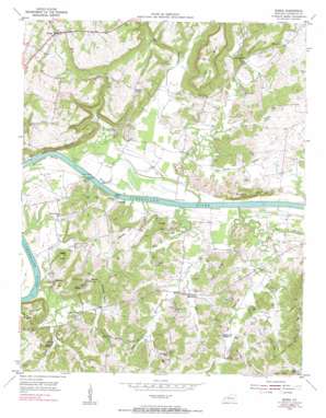
Burna Topo Map Kentucky
To zoom in, hover over the map of Burna
USGS Topo Quad 37088b3 - 1:24,000 scale
| Topo Map Name: | Burna |
| USGS Topo Quad ID: | 37088b3 |
| Print Size: | ca. 21 1/4" wide x 27" high |
| Southeast Coordinates: | 37.125° N latitude / 88.25° W longitude |
| Map Center Coordinates: | 37.1875° N latitude / 88.3125° W longitude |
| U.S. State: | KY |
| Filename: | o37088b3.jpg |
| Download Map JPG Image: | Burna topo map 1:24,000 scale |
| Map Type: | Topographic |
| Topo Series: | 7.5´ |
| Map Scale: | 1:24,000 |
| Source of Map Images: | United States Geological Survey (USGS) |
| Alternate Map Versions: |
Burna KY 1954, updated 1955 Download PDF Buy paper map Burna KY 1954, updated 1973 Download PDF Buy paper map Burna KY 2010 Download PDF Buy paper map Burna KY 2013 Download PDF Buy paper map Burna KY 2016 Download PDF Buy paper map |
1:24,000 Topo Quads surrounding Burna
> Back to 37088a1 at 1:100,000 scale
> Back to 37088a1 at 1:250,000 scale
> Back to U.S. Topo Maps home
Burna topo map: Gazetteer
Burna: Airports
Barnes Farm Airport elevation 159m 521′Burna: Bends
Horseshoe Bend elevation 102m 334′Burna: Cliffs
Bissell Bluff elevation 121m 396′Dobson Bluff elevation 156m 511′
Lockhart Bluff elevation 154m 505′
Vicks Bluffs elevation 152m 498′
Burna: Mines
Atwood Mines elevation 111m 364′Franklin Quarry elevation 147m 482′
Hudson Mine elevation 119m 390′
Klondike Mine elevation 111m 364′
Kolb Quarry elevation 143m 469′
Lovelace Mine elevation 123m 403′
Rudd Quarry elevation 98m 321′
Burna: Populated Places
Burna elevation 167m 547′Heater elevation 149m 488′
Lemen Landing elevation 101m 331′
Mitchell Landing elevation 94m 308′
Moxley Landing elevation 97m 318′
Mullikin Junction elevation 174m 570′
Vicksburg elevation 104m 341′
Burna: Ridges
Harp Ridge elevation 148m 485′Oak Ridge elevation 138m 452′
Burna: Springs
Doom Spring elevation 111m 364′Lower Ferguson Spring elevation 112m 367′
Mint Springs elevation 106m 347′
Rocked Spring elevation 162m 531′
Burna: Streams
Bissell Creek elevation 97m 318′Clear Branch elevation 98m 321′
Cook Spring Branch elevation 98m 321′
Doom Spring Branch elevation 103m 337′
Dry Fork elevation 98m 321′
Dunn Creek elevation 98m 321′
Ferguson Creek elevation 92m 301′
Hazel Branch elevation 98m 321′
Hickory Creek elevation 92m 301′
Lick Creek elevation 97m 318′
Rocky Branch elevation 100m 328′
Sandy Creek elevation 104m 341′
Smith Creek elevation 94m 308′
Snglin Creek elevation 102m 334′
Sugar Creek elevation 95m 311′
Burna: Summits
Bald Knob elevation 175m 574′Barricks Hill elevation 132m 433′
Dunlap Hill elevation 146m 479′
Frozen Knob elevation 166m 544′
Gravel Hill elevation 180m 590′
Hampton Hill elevation 138m 452′
Harris Hill elevation 138m 452′
Haw Hill elevation 154m 505′
Jewel Hill elevation 130m 426′
Kibbler Hill elevation 135m 442′
Leeper Hill elevation 126m 413′
Vick Hill elevation 145m 475′
Burna: Valleys
Grassham Hollow elevation 107m 351′Low Gap Hollow elevation 108m 354′
Polecat Hollow elevation 103m 337′
Steep Hollow elevation 96m 314′
Burna digital topo map on disk
Buy this Burna topo map showing relief, roads, GPS coordinates and other geographical features, as a high-resolution digital map file on DVD:


