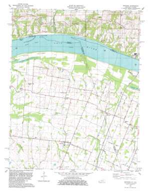
Bandana Topo Map Kentucky
To zoom in, hover over the map of Bandana
USGS Topo Quad 37088b8 - 1:24,000 scale
| Topo Map Name: | Bandana |
| USGS Topo Quad ID: | 37088b8 |
| Print Size: | ca. 21 1/4" wide x 27" high |
| Southeast Coordinates: | 37.125° N latitude / 88.875° W longitude |
| Map Center Coordinates: | 37.1875° N latitude / 88.9375° W longitude |
| U.S. States: | KY, IL |
| Filename: | o37088b8.jpg |
| Download Map JPG Image: | Bandana topo map 1:24,000 scale |
| Map Type: | Topographic |
| Topo Series: | 7.5´ |
| Map Scale: | 1:24,000 |
| Source of Map Images: | United States Geological Survey (USGS) |
| Alternate Map Versions: |
Bandana KY 1954, updated 1955 Download PDF Buy paper map Bandana KY 1966, updated 1968 Download PDF Buy paper map Bandana KY 1982, updated 1983 Download PDF Buy paper map Bandana KY 2010 Download PDF Buy paper map Bandana KY 2013 Download PDF Buy paper map Bandana KY 2016 Download PDF Buy paper map |
1:24,000 Topo Quads surrounding Bandana
> Back to 37088a1 at 1:100,000 scale
> Back to 37088a1 at 1:250,000 scale
> Back to U.S. Topo Maps home
Bandana topo map: Gazetteer
Bandana: Channels
Grand Chain elevation 88m 288′Bandana: Lakes
Colvin Lake elevation 94m 308′Crawford Lake elevation 95m 311′
Little Colvin Lake elevation 94m 308′
Bandana: Pillars
Hillerman Rock elevation 88m 288′Bandana: Populated Places
Bandana elevation 107m 351′Hillerman elevation 119m 390′
Monkeys Eyebrow elevation 110m 360′
Needmore elevation 111m 364′
Ragland elevation 112m 367′
Bandana: Streams
Bone Branch elevation 98m 321′Hanley Creek elevation 100m 328′
Newtons Creek elevation 88m 288′
Post Creek Cutoff elevation 91m 298′
Redstone Creek elevation 89m 291′
Bandana digital topo map on disk
Buy this Bandana topo map showing relief, roads, GPS coordinates and other geographical features, as a high-resolution digital map file on DVD:


