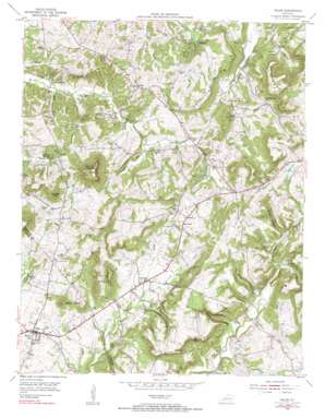
Salem Topo Map Kentucky
To zoom in, hover over the map of Salem
USGS Topo Quad 37088c2 - 1:24,000 scale
| Topo Map Name: | Salem |
| USGS Topo Quad ID: | 37088c2 |
| Print Size: | ca. 21 1/4" wide x 27" high |
| Southeast Coordinates: | 37.25° N latitude / 88.125° W longitude |
| Map Center Coordinates: | 37.3125° N latitude / 88.1875° W longitude |
| U.S. State: | KY |
| Filename: | o37088c2.jpg |
| Download Map JPG Image: | Salem topo map 1:24,000 scale |
| Map Type: | Topographic |
| Topo Series: | 7.5´ |
| Map Scale: | 1:24,000 |
| Source of Map Images: | United States Geological Survey (USGS) |
| Alternate Map Versions: |
Salem KY 1954, updated 1955 Download PDF Buy paper map Salem KY 1954, updated 1984 Download PDF Buy paper map Salem KY 2010 Download PDF Buy paper map Salem KY 2013 Download PDF Buy paper map Salem KY 2016 Download PDF Buy paper map |
1:24,000 Topo Quads surrounding Salem
> Back to 37088a1 at 1:100,000 scale
> Back to 37088a1 at 1:250,000 scale
> Back to U.S. Topo Maps home
Salem topo map: Gazetteer
Salem: Areas
Memphis Prospect Area elevation 166m 544′Salem: Basins
Panther Hollow elevation 127m 416′Salem: Cliffs
Childress Bluff elevation 165m 541′Griffith Bluff elevation 133m 436′
John Thomas Bluff elevation 225m 738′
Kirk Bluff elevation 130m 426′
York Bluff elevation 181m 593′
Salem: Mines
Ada Florence Mine elevation 144m 472′Atlas Mine elevation 136m 446′
Babb Mine elevation 138m 452′
Bebout Mine elevation 167m 547′
Big Four Mine elevation 123m 403′
Butler Mines elevation 126m 413′
Clement Mine elevation 124m 406′
Columbia Mine elevation 122m 400′
Commodore Mine elevation 144m 472′
Corn Mine elevation 139m 456′
Crystal Mines elevation 135m 442′
Davenport Mine elevation 137m 449′
Dell-High Mine elevation 146m 479′
Eagle-Babb Mine elevation 143m 469′
Franklin Mines elevation 149m 488′
Glendale Mines elevation 152m 498′
Gray Mine elevation 137m 449′
Hickory Cane Mine elevation 139m 456′
Holly Mine elevation 140m 459′
Horse Lot Mine elevation 128m 419′
Jim Belt Mine elevation 144m 472′
K K Mines elevation 155m 508′
Keystone Mine and Fluorite Floatation Mill elevation 153m 501′
La Rue Mine elevation 125m 410′
Mary Belle Mines elevation 140m 459′
Miller Mines elevation 144m 472′
Nine Acre Mine elevation 128m 419′
Old Jim Mine elevation 138m 452′
Sumner Mine elevation 151m 495′
Salem: Populated Places
Levias elevation 145m 475′Midway elevation 159m 521′
New Salem elevation 130m 426′
Salem elevation 135m 442′
Sheridan elevation 162m 531′
View elevation 134m 439′
Salem: Springs
Crittenden Spring elevation 125m 410′Crodson Spring elevation 125m 410′
Salem: Streams
Buck Branch elevation 112m 367′Clement Creek elevation 104m 341′
Corn Branch elevation 113m 370′
Crodson Creek elevation 118m 387′
Dry Fork Creek elevation 127m 416′
Kit Love Branch elevation 122m 400′
Little Hurricane Creek elevation 122m 400′
New Salem Creek elevation 128m 419′
Preacher Creek elevation 122m 400′
Salem: Summits
Cave Hill elevation 208m 682′Eberle Knobs elevation 204m 669′
Hardin Knob elevation 251m 823′
Kirk Knobs elevation 205m 672′
Moore Hill elevation 201m 659′
Salem: Valleys
Brown Hollow elevation 114m 374′Clifty Hollow elevation 107m 351′
Hurricane Hollow elevation 128m 419′
Steep Hollow elevation 134m 439′
Salem digital topo map on disk
Buy this Salem topo map showing relief, roads, GPS coordinates and other geographical features, as a high-resolution digital map file on DVD:


