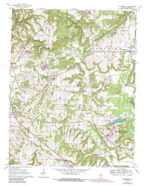
Bloomfield Topo Map Illinois
To zoom in, hover over the map of Bloomfield
USGS Topo Quad 37088d7 - 1:24,000 scale
| Topo Map Name: | Bloomfield |
| USGS Topo Quad ID: | 37088d7 |
| Print Size: | ca. 21 1/4" wide x 27" high |
| Southeast Coordinates: | 37.375° N latitude / 88.75° W longitude |
| Map Center Coordinates: | 37.4375° N latitude / 88.8125° W longitude |
| U.S. State: | IL |
| Filename: | o37088d7.jpg |
| Download Map JPG Image: | Bloomfield topo map 1:24,000 scale |
| Map Type: | Topographic |
| Topo Series: | 7.5´ |
| Map Scale: | 1:24,000 |
| Source of Map Images: | United States Geological Survey (USGS) |
| Alternate Map Versions: |
Bloomfield IL 1966, updated 1967 Download PDF Buy paper map Bloomfield IL 1966, updated 1978 Download PDF Buy paper map Bloomfield IL 1966, updated 1990 Download PDF Buy paper map Bloomfield IL 1996, updated 1998 Download PDF Buy paper map Bloomfield IL 2012 Download PDF Buy paper map Bloomfield IL 2015 Download PDF Buy paper map |
| FStopo: | US Forest Service topo Bloomfield is available: Download FStopo PDF Download FStopo TIF |
1:24,000 Topo Quads surrounding Bloomfield
> Back to 37088a1 at 1:100,000 scale
> Back to 37088a1 at 1:250,000 scale
> Back to U.S. Topo Maps home
Bloomfield topo map: Gazetteer
Bloomfield: Airports
Covey Airport elevation 192m 629′Vienna Correctional Center Heliport elevation 149m 488′
Bloomfield: Crossings
Interchange 16 elevation 126m 413′Bloomfield: Dams
Bay Creek Structure Number 4 Dam elevation 113m 370′Correctional Center Dam elevation 111m 364′
Little Cache Structure Number 1 Dam elevation 130m 426′
Little Cache Structure Number 10 Dam elevation 125m 410′
Little Cache Structure Number 5 Dam elevation 128m 419′
Little Cache Structure Number 8 Dam elevation 123m 403′
Bloomfield: Populated Places
Cross Roads (historical) elevation 132m 433′Pond elevation 161m 528′
Simpson elevation 119m 390′
Wartrace elevation 152m 498′
Bloomfield: Reservoirs
Little Cache Number 1 Reservoir elevation 127m 416′Little Cache Number 5 Reservoir elevation 128m 419′
Vienna City Lake elevation 124m 406′
Vienna Correctional Center Lake elevation 111m 364′
Bloomfield: Springs
Casey Spring elevation 135m 442′Shoemaker Spring elevation 132m 433′
Bloomfield: Streams
Cedar Creek elevation 109m 357′East Branch Cedar Creek elevation 121m 396′
Max Creek elevation 110m 360′
Mill Creek elevation 110m 360′
Bloomfield: Summits
Taylor Bluff elevation 170m 557′Bloomfield digital topo map on disk
Buy this Bloomfield topo map showing relief, roads, GPS coordinates and other geographical features, as a high-resolution digital map file on DVD:


