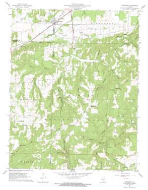
Stonefort Topo Map Illinois
To zoom in, hover over the map of Stonefort
USGS Topo Quad 37088e6 - 1:24,000 scale
| Topo Map Name: | Stonefort |
| USGS Topo Quad ID: | 37088e6 |
| Print Size: | ca. 21 1/4" wide x 27" high |
| Southeast Coordinates: | 37.5° N latitude / 88.625° W longitude |
| Map Center Coordinates: | 37.5625° N latitude / 88.6875° W longitude |
| U.S. State: | IL |
| Filename: | o37088e6.jpg |
| Download Map JPG Image: | Stonefort topo map 1:24,000 scale |
| Map Type: | Topographic |
| Topo Series: | 7.5´ |
| Map Scale: | 1:24,000 |
| Source of Map Images: | United States Geological Survey (USGS) |
| Alternate Map Versions: |
Stonefort IL 1961, updated 1962 Download PDF Buy paper map Stonefort IL 1961, updated 1974 Download PDF Buy paper map Stonefort IL 1996, updated 1998 Download PDF Buy paper map Stonefort IL 2012 Download PDF Buy paper map Stonefort IL 2015 Download PDF Buy paper map |
| FStopo: | US Forest Service topo Stonefort is available: Download FStopo PDF Download FStopo TIF |
1:24,000 Topo Quads surrounding Stonefort
> Back to 37088e1 at 1:100,000 scale
> Back to 37088a1 at 1:250,000 scale
> Back to U.S. Topo Maps home
Stonefort topo map: Gazetteer
Stonefort: Cliffs
Stonefort Bluff elevation 141m 462′Stonefort: Falls
Burden Falls elevation 165m 541′Cedar Falls elevation 134m 439′
Stonefort: Forests
Shawnee National Forest elevation 172m 564′Stonefort: Populated Places
Abbot elevation 149m 488′McCormick elevation 223m 731′
Oldtown elevation 131m 429′
Stonefort elevation 125m 410′
Watkins Ford elevation 160m 524′
Stonefort: Reservoirs
Teal Pond elevation 202m 662′Stonefort: Streams
Allen Branch elevation 127m 416′Burden Creek elevation 120m 393′
Caney Branch elevation 121m 396′
Clifty Creek elevation 129m 423′
Dry Fork elevation 138m 452′
Grassy Creek elevation 116m 380′
Hill Branch elevation 132m 433′
Hunting Branch elevation 134m 439′
Ogden Branch elevation 121m 396′
Spring Branch elevation 134m 439′
Waltons Branch elevation 128m 419′
Stonefort: Summits
Sand Hill elevation 172m 564′Stonefort: Valleys
Bill Hill Hollow elevation 117m 383′Buzzard Roost Hollow elevation 122m 400′
Jackson Hollow elevation 143m 469′
John Mack Hollow elevation 124m 406′
Katy Reid Hollow elevation 127m 416′
Stonefort digital topo map on disk
Buy this Stonefort topo map showing relief, roads, GPS coordinates and other geographical features, as a high-resolution digital map file on DVD:


