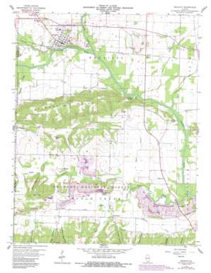
Equality Topo Map Illinois
To zoom in, hover over the map of Equality
USGS Topo Quad 37088f3 - 1:24,000 scale
| Topo Map Name: | Equality |
| USGS Topo Quad ID: | 37088f3 |
| Print Size: | ca. 21 1/4" wide x 27" high |
| Southeast Coordinates: | 37.625° N latitude / 88.25° W longitude |
| Map Center Coordinates: | 37.6875° N latitude / 88.3125° W longitude |
| U.S. State: | IL |
| Filename: | o37088f3.jpg |
| Download Map JPG Image: | Equality topo map 1:24,000 scale |
| Map Type: | Topographic |
| Topo Series: | 7.5´ |
| Map Scale: | 1:24,000 |
| Source of Map Images: | United States Geological Survey (USGS) |
| Alternate Map Versions: |
Equality IL 1959, updated 1960 Download PDF Buy paper map Equality IL 1959, updated 1972 Download PDF Buy paper map Equality IL 1959, updated 1990 Download PDF Buy paper map Equality IL 1996, updated 1998 Download PDF Buy paper map Equality IL 2012 Download PDF Buy paper map Equality IL 2015 Download PDF Buy paper map |
| FStopo: | US Forest Service topo Equality is available: Download FStopo PDF Download FStopo TIF |
1:24,000 Topo Quads surrounding Equality
> Back to 37088e1 at 1:100,000 scale
> Back to 37088a1 at 1:250,000 scale
> Back to U.S. Topo Maps home
Equality topo map: Gazetteer
Equality: Bridges
Island Ripple Bridge (historical) elevation 103m 337′Equality: Canals
Lawler Ditch elevation 107m 351′Equality: Crossings
Eagle Ripple Ford elevation 102m 334′Equality: Mines
Berkel Mine elevation 122m 400′Equality: Populated Places
Equality elevation 125m 410′Gibsonia elevation 111m 364′
Kedron elevation 120m 393′
Lawler elevation 112m 367′
Leamington elevation 120m 393′
Equality: Ranges
Wildcat Hills elevation 197m 646′Equality: Streams
Black Branch elevation 106m 347′Cockerel Branch elevation 103m 337′
Eagle Creek elevation 103m 337′
Horseshoe Creek elevation 103m 337′
Hutt Creek elevation 108m 354′
Little Eagle Creek elevation 103m 337′
North Fork Saline River elevation 103m 337′
Robinette Creek elevation 106m 347′
Sugarcamp Branch elevation 106m 347′
Equality: Summits
Maher Hill elevation 188m 616′Equality: Valleys
Burnt Shanty Hollow elevation 113m 370′Captain Vinyard Hollow elevation 120m 393′
Clayton Hollow elevation 112m 367′
Colbert Hollow elevation 119m 390′
Poplar Hollow elevation 113m 370′
Pounds Hollow elevation 116m 380′
Rice Hollow elevation 120m 393′
Thacker Hollow elevation 114m 374′
Equality: Wells
Negro Spring Salt Well elevation 105m 344′Equality digital topo map on disk
Buy this Equality topo map showing relief, roads, GPS coordinates and other geographical features, as a high-resolution digital map file on DVD:


