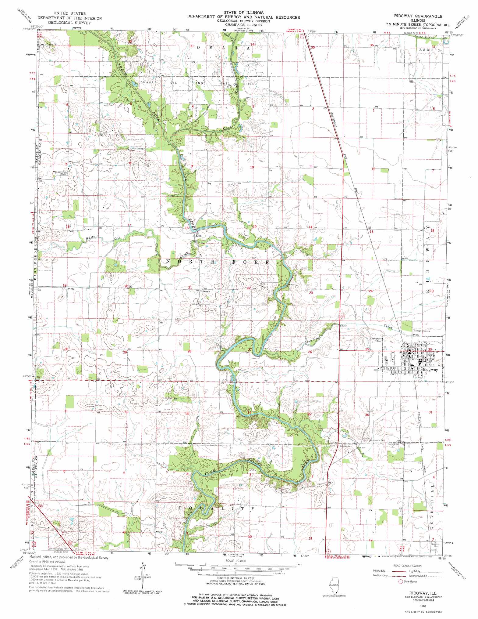
Ridgway Topo Map Illinois
To zoom in, hover over the map of Ridgway
USGS Topo Quad 37088g3 - 1:24,000 scale
| Topo Map Name: | Ridgway |
| USGS Topo Quad ID: | 37088g3 |
| Print Size: | ca. 21 1/4" wide x 27" high |
| Southeast Coordinates: | 37.75° N latitude / 88.25° W longitude |
| Map Center Coordinates: | 37.8125° N latitude / 88.3125° W longitude |
| U.S. State: | IL |
| Filename: | o37088g3.jpg |
| Download Map JPG Image: | Ridgway topo map 1:24,000 scale |
| Map Type: | Topographic |
| Topo Series: | 7.5´ |
| Map Scale: | 1:24,000 |
| Source of Map Images: | United States Geological Survey (USGS) |
| Alternate Map Versions: |
Ridgway IL 1963, updated 1964 Download PDF Buy paper map Ridgway IL 1963, updated 1986 Download PDF Buy paper map Ridgway IL 2012 Download PDF Buy paper map Ridgway IL 2015 Download PDF Buy paper map |
1:24,000 Topo Quads surrounding Ridgway
Mcleansboro |
Thackeray |
Enfield |
Carmi |
Maunie |
Walpole |
Broughton |
Norris City |
New Haven |
Emma |
Galatia |
Eldorado |
Ridgway |
New Haven Sw |
Wabash Island |
Harrisburg |
Rudement |
Equality |
Shawneetown |
Grove Center |
Eddyville |
Herod |
Karbers Ridge |
Saline Mines |
Dekoven |
> Back to 37088e1 at 1:100,000 scale
> Back to 37088a1 at 1:250,000 scale
> Back to U.S. Topo Maps home
Ridgway topo map: Gazetteer
Ridgway: Oilfields
Omaha Oil and Gas Field elevation 112m 367′Ridgway: Populated Places
Elba elevation 111m 364′Ridgway elevation 114m 374′
Ridgway: Streams
Bear Creek elevation 107m 351′Cane Creek elevation 103m 337′
Crawford Creek elevation 103m 337′
White Oak Creek elevation 104m 341′
Ridgway digital topo map on disk
Buy this Ridgway topo map showing relief, roads, GPS coordinates and other geographical features, as a high-resolution digital map file on DVD: