Harco Topo Map Illinois
To zoom in, hover over the map of Harco
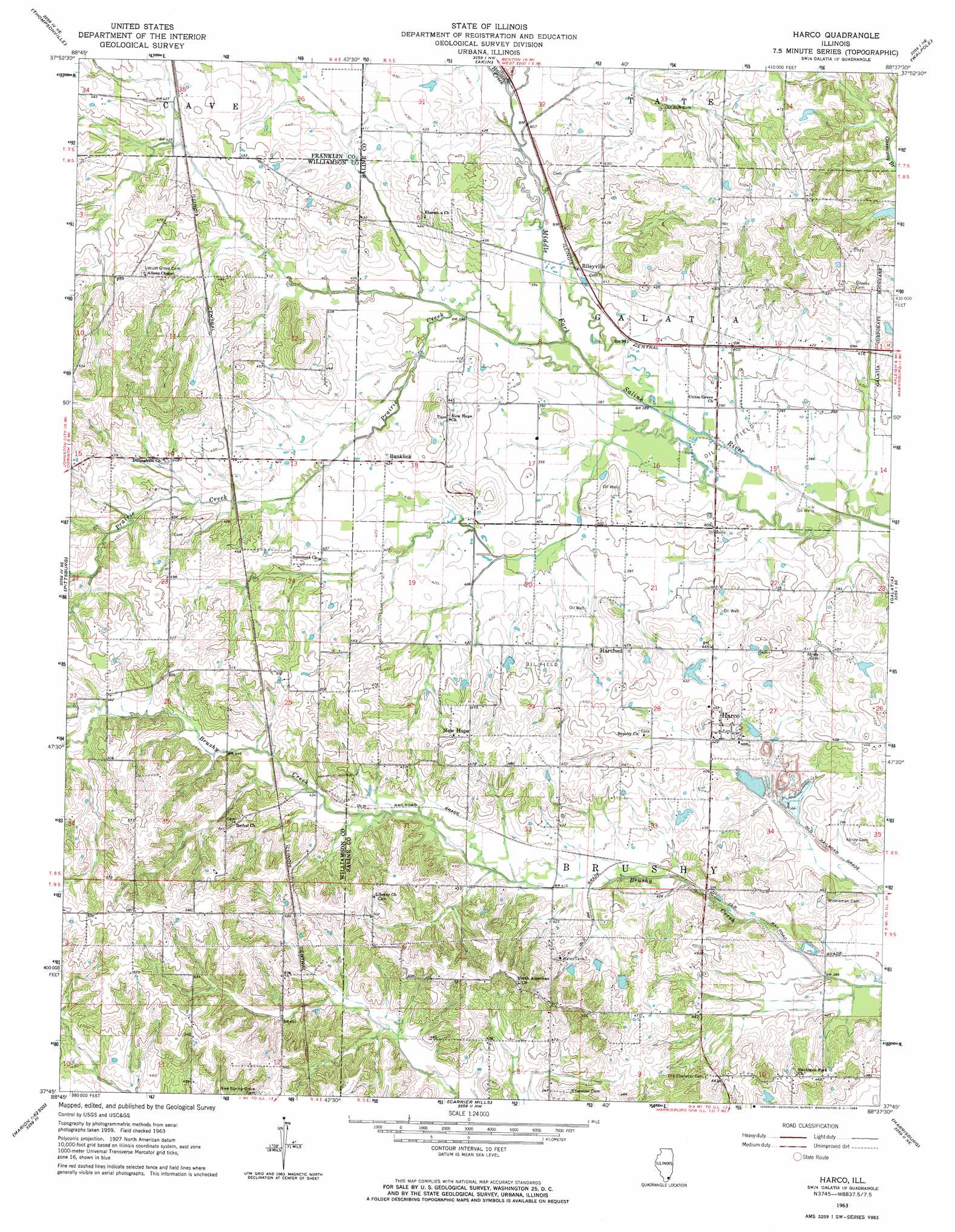
USGS Topo Quad 37088g6 - 1:24,000 scale
| Topo Map Name: | Harco |
| USGS Topo Quad ID: | 37088g6 |
| Print Size: | ca. 21 1/4" wide x 27" high |
| Southeast Coordinates: | 37.75° N latitude / 88.625° W longitude |
| Map Center Coordinates: | 37.8125° N latitude / 88.6875° W longitude |
| U.S. State: | IL |
| Filename: | o37088g6.jpg |
| Download Map JPG Image: | Harco topo map 1:24,000 scale |
| Map Type: | Topographic |
| Topo Series: | 7.5´ |
| Map Scale: | 1:24,000 |
| Source of Map Images: | United States Geological Survey (USGS) |
| Alternate Map Versions: |
Harco IL 1963, updated 1964 Download PDF Buy paper map Harco IL 2012 Download PDF Buy paper map Harco IL 2015 Download PDF Buy paper map |
1:24,000 Topo Quads surrounding Harco
Rend Lake Dam |
Ewing |
Macedonia |
Mcleansboro |
Thackeray |
West Frankfort |
Thompsonville |
Akin |
Walpole |
Broughton |
Johnston City |
Pittsburg |
Harco |
Galatia |
Eldorado |
Marion |
Crab Orchard |
Carrier Mills |
Harrisburg |
Rudement |
Goreville |
Creal Springs |
Stonefort |
Eddyville |
Herod |
> Back to 37088e1 at 1:100,000 scale
> Back to 37088a1 at 1:250,000 scale
> Back to U.S. Topo Maps home
Harco topo map: Gazetteer
Harco: Populated Places
Banklick elevation 130m 426′Harco elevation 137m 449′
Hartford elevation 133m 436′
Locust Grove (historical) elevation 128m 419′
New Hope elevation 149m 488′
Rileyville elevation 122m 400′
Harco: Streams
Halltown Creek elevation 122m 400′Prairie Creek elevation 116m 380′
Harco digital topo map on disk
Buy this Harco topo map showing relief, roads, GPS coordinates and other geographical features, as a high-resolution digital map file on DVD: