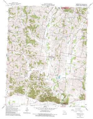
Gordonville Topo Map Missouri
To zoom in, hover over the map of Gordonville
USGS Topo Quad 37089c6 - 1:24,000 scale
| Topo Map Name: | Gordonville |
| USGS Topo Quad ID: | 37089c6 |
| Print Size: | ca. 21 1/4" wide x 27" high |
| Southeast Coordinates: | 37.25° N latitude / 89.625° W longitude |
| Map Center Coordinates: | 37.3125° N latitude / 89.6875° W longitude |
| U.S. State: | MO |
| Filename: | o37089c6.jpg |
| Download Map JPG Image: | Gordonville topo map 1:24,000 scale |
| Map Type: | Topographic |
| Topo Series: | 7.5´ |
| Map Scale: | 1:24,000 |
| Source of Map Images: | United States Geological Survey (USGS) |
| Alternate Map Versions: |
Gordonville MO 1967, updated 1968 Download PDF Buy paper map Gordonville MO 1967, updated 1984 Download PDF Buy paper map Gordonville MO 2012 Download PDF Buy paper map Gordonville MO 2015 Download PDF Buy paper map |
1:24,000 Topo Quads surrounding Gordonville
> Back to 37089a1 at 1:100,000 scale
> Back to 37088a1 at 1:250,000 scale
> Back to U.S. Topo Maps home
Gordonville topo map: Gazetteer
Gordonville: Areas
Southeast Lowlands elevation 103m 337′Gordonville: Dams
Evans Lake East Dam elevation 114m 374′Evans Lake West Dam elevation 125m 410′
Number 786 Dam elevation 138m 452′
Number 804 Dam elevation 111m 364′
Number 805 Dam elevation 119m 390′
Pemberton Lake Dam - US Survey 2283 Dam elevation 110m 360′
Pemberton Lake Section 22 Dam elevation 114m 374′
Gordonville: Populated Places
Dutchtown elevation 107m 351′Gordonville elevation 120m 393′
Houck elevation 158m 518′
Tilsit elevation 149m 488′
Gordonville: Reservoirs
Evans Lake East elevation 114m 374′Evans Lake West elevation 125m 410′
Pemberton Lake elevation 110m 360′
Pemberton Lake Section 22 elevation 114m 374′
Gordonville: Streams
Foster Creek elevation 109m 357′Goose Creek elevation 118m 387′
Randol Creek elevation 112m 367′
Williams Creek elevation 106m 347′
Gordonville digital topo map on disk
Buy this Gordonville topo map showing relief, roads, GPS coordinates and other geographical features, as a high-resolution digital map file on DVD:


