Wolf Lake Topo Map Illinois
To zoom in, hover over the map of Wolf Lake
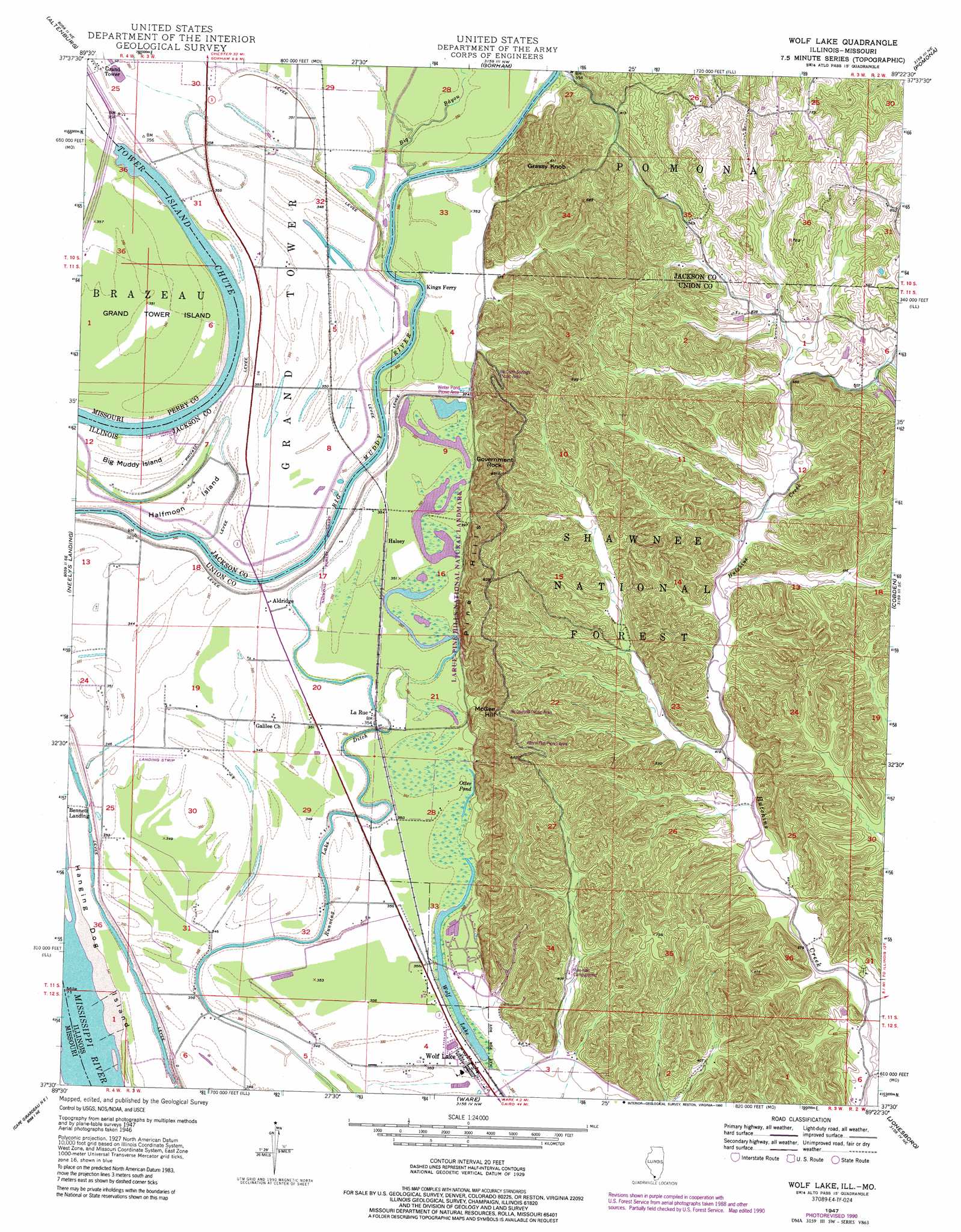
USGS Topo Quad 37089e4 - 1:24,000 scale
| Topo Map Name: | Wolf Lake |
| USGS Topo Quad ID: | 37089e4 |
| Print Size: | ca. 21 1/4" wide x 27" high |
| Southeast Coordinates: | 37.5° N latitude / 89.375° W longitude |
| Map Center Coordinates: | 37.5625° N latitude / 89.4375° W longitude |
| U.S. States: | IL, MO |
| Filename: | o37089e4.jpg |
| Download Map JPG Image: | Wolf Lake topo map 1:24,000 scale |
| Map Type: | Topographic |
| Topo Series: | 7.5´ |
| Map Scale: | 1:24,000 |
| Source of Map Images: | United States Geological Survey (USGS) |
| Alternate Map Versions: |
Wolf Lake IL 1947, updated 1966 Download PDF Buy paper map Wolf Lake IL 1947, updated 1990 Download PDF Buy paper map Wolf Lake IL 1948 Download PDF Buy paper map Wolf Lake IL 1994, updated 1996 Download PDF Buy paper map Wolf Lake IL 2012 Download PDF Buy paper map Wolf Lake IL 2015 Download PDF Buy paper map |
| FStopo: | US Forest Service topo Wolf Lake is available: Download FStopo PDF Download FStopo TIF |
1:24,000 Topo Quads surrounding Wolf Lake
Rockwood |
Raddle |
Oraville |
Murphysboro |
Desoto |
Crosstown |
Altenburg |
Gorham |
Pomona |
Carbondale |
Oak Ridge |
Neelys Landing |
Wolf Lake |
Cobden |
Makanda |
Jackson |
Cape Girardeau Ne |
Ware |
Jonesboro |
Anna |
Gordonville |
Cape Girardeau |
Mcclure |
Mill Creek |
Dongola |
> Back to 37089e1 at 1:100,000 scale
> Back to 37088a1 at 1:250,000 scale
> Back to U.S. Topo Maps home
Wolf Lake topo map: Gazetteer
Wolf Lake: Airports
Lambdins Field elevation 107m 351′Wolf Lake: Arches
Preachers Eye elevation 136m 446′Wolf Lake: Guts
Tower Island Chute elevation 103m 337′Wolf Lake: Islands
Big Muddy Island elevation 106m 347′Grand Tower Island elevation 106m 347′
Halfmoon Island elevation 107m 351′
Hanging Dog Island elevation 104m 341′
Wolf Lake: Lakes
Otter Pond elevation 108m 354′Wolf Lake elevation 107m 351′
Wolf Lake: Parks
La Rue Swamp Nature Preserve elevation 108m 354′Larue-Pine Hills National Natural Landmark elevation 107m 351′
Wolf Lake: Populated Places
Aldridge elevation 107m 351′Bennett Landing elevation 106m 347′
Halsey elevation 108m 354′
La Rue elevation 107m 351′
Wolf Lake elevation 108m 354′
Wolf Lake: Post Offices
Wolf Lake Post Office elevation 108m 354′Wolf Lake: Ranges
Pine Hills elevation 203m 666′Wolf Lake: Streams
Big Bayou elevation 104m 341′Hutchins Creek elevation 110m 360′
Wolf Lake: Summits
Government Rock elevation 250m 820′Grassy Knob elevation 243m 797′
McGee Hill elevation 240m 787′
Wolf Lake digital topo map on disk
Buy this Wolf Lake topo map showing relief, roads, GPS coordinates and other geographical features, as a high-resolution digital map file on DVD: