Crosstown Topo Map Missouri
To zoom in, hover over the map of Crosstown
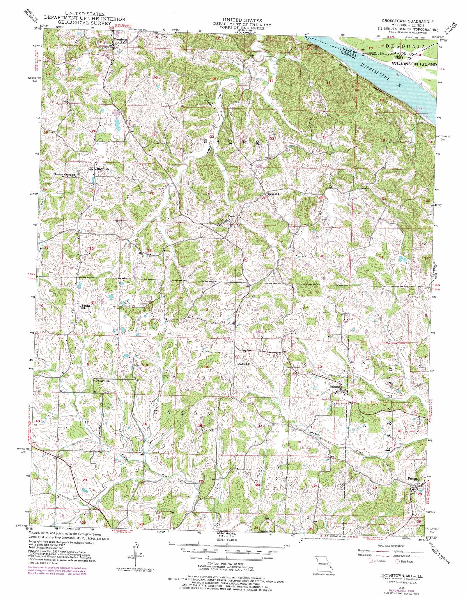
USGS Topo Quad 37089f6 - 1:24,000 scale
| Topo Map Name: | Crosstown |
| USGS Topo Quad ID: | 37089f6 |
| Print Size: | ca. 21 1/4" wide x 27" high |
| Southeast Coordinates: | 37.625° N latitude / 89.625° W longitude |
| Map Center Coordinates: | 37.6875° N latitude / 89.6875° W longitude |
| U.S. States: | MO, IL |
| Filename: | o37089f6.jpg |
| Download Map JPG Image: | Crosstown topo map 1:24,000 scale |
| Map Type: | Topographic |
| Topo Series: | 7.5´ |
| Map Scale: | 1:24,000 |
| Source of Map Images: | United States Geological Survey (USGS) |
| Alternate Map Versions: |
Crosstown MO 1947, updated 1960 Download PDF Buy paper map Crosstown MO 1947, updated 1975 Download PDF Buy paper map Crosstown MO 1948 Download PDF Buy paper map Crosstown MO 1993, updated 1996 Download PDF Buy paper map Crosstown MO 2012 Download PDF Buy paper map Crosstown MO 2015 Download PDF Buy paper map |
1:24,000 Topo Quads surrounding Crosstown
Kaskaskia |
Chester |
Welge |
Willisville |
Ava |
Lithium |
Belgique |
Rockwood |
Raddle |
Oraville |
Perryville West |
Perryville East |
Crosstown |
Altenburg |
Gorham |
Sedgewickville |
Friedheim |
Oak Ridge |
Neelys Landing |
Wolf Lake |
Scopus |
Millersville |
Jackson |
Cape Girardeau Ne |
Ware |
> Back to 37089e1 at 1:100,000 scale
> Back to 37088a1 at 1:250,000 scale
> Back to U.S. Topo Maps home
Crosstown digital topo map on disk
Buy this Crosstown topo map showing relief, roads, GPS coordinates and other geographical features, as a high-resolution digital map file on DVD: