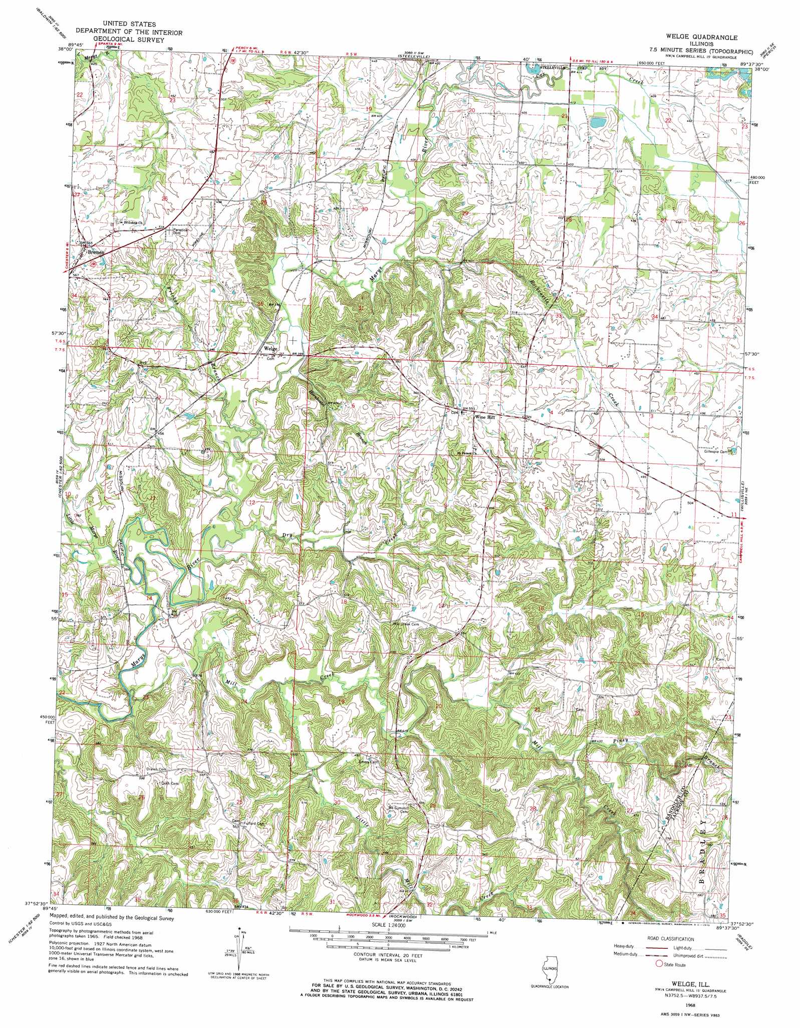
Welge Topo Map Illinois
To zoom in, hover over the map of Welge
USGS Topo Quad 37089h6 - 1:24,000 scale
| Topo Map Name: | Welge |
| USGS Topo Quad ID: | 37089h6 |
| Print Size: | ca. 21 1/4" wide x 27" high |
| Southeast Coordinates: | 37.875° N latitude / 89.625° W longitude |
| Map Center Coordinates: | 37.9375° N latitude / 89.6875° W longitude |
| U.S. State: | IL |
| Filename: | o37089h6.jpg |
| Download Map JPG Image: | Welge topo map 1:24,000 scale |
| Map Type: | Topographic |
| Topo Series: | 7.5´ |
| Map Scale: | 1:24,000 |
| Source of Map Images: | United States Geological Survey (USGS) |
| Alternate Map Versions: |
Welge IL 1968, updated 1970 Download PDF Buy paper map Welge IL 2012 Download PDF Buy paper map Welge IL 2015 Download PDF Buy paper map |
1:24,000 Topo Quads surrounding Welge
Red Bud |
Baldwin |
Tilden |
Coulterville |
Winkle |
Evansville |
Walsh |
Steeleville |
Percy |
Pinckneyville |
Kaskaskia |
Chester |
Welge |
Willisville |
Ava |
Lithium |
Belgique |
Rockwood |
Raddle |
Oraville |
Perryville West |
Perryville East |
Crosstown |
Altenburg |
Gorham |
> Back to 37089e1 at 1:100,000 scale
> Back to 37088a1 at 1:250,000 scale
> Back to U.S. Topo Maps home
Welge topo map: Gazetteer
Welge: Dams
Crescent Club Lake Dam elevation 128m 419′Welge: Parks
Piney Creek Ravine Nature Preserve elevation 171m 561′Welge: Populated Places
Bremen elevation 171m 561′Leanderville elevation 170m 557′
Randolph elevation 173m 567′
Welge elevation 123m 403′
Wine Hill elevation 177m 580′
Welge: Reservoirs
Crescent Club Lake elevation 128m 419′Welge: Streams
Cox Creek elevation 122m 400′Dry Creek elevation 114m 374′
Frickes Branch elevation 113m 370′
Hornbostel Branch elevation 115m 377′
Little Marys River elevation 109m 357′
Little Mill Creek elevation 115m 377′
Mill Creek elevation 109m 357′
North Fork Cox Creek elevation 126m 413′
Piney Branch elevation 128m 419′
Rockcastle Creek elevation 121m 396′
Welge digital topo map on disk
Buy this Welge topo map showing relief, roads, GPS coordinates and other geographical features, as a high-resolution digital map file on DVD: