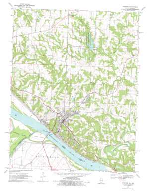
Chester Topo Map Illinois
To zoom in, hover over the map of Chester
USGS Topo Quad 37089h7 - 1:24,000 scale
| Topo Map Name: | Chester |
| USGS Topo Quad ID: | 37089h7 |
| Print Size: | ca. 21 1/4" wide x 27" high |
| Southeast Coordinates: | 37.875° N latitude / 89.75° W longitude |
| Map Center Coordinates: | 37.9375° N latitude / 89.8125° W longitude |
| U.S. States: | IL, MO |
| Filename: | o37089h7.jpg |
| Download Map JPG Image: | Chester topo map 1:24,000 scale |
| Map Type: | Topographic |
| Topo Series: | 7.5´ |
| Map Scale: | 1:24,000 |
| Source of Map Images: | United States Geological Survey (USGS) |
| Alternate Map Versions: |
Chester IL 1968, updated 1993 Download PDF Buy paper map Chester IL 1970, updated 1972 Download PDF Buy paper map Chester IL 1970, updated 1977 Download PDF Buy paper map Chester IL 2012 Download PDF Buy paper map Chester IL 2015 Download PDF Buy paper map |
1:24,000 Topo Quads surrounding Chester
> Back to 37089e1 at 1:100,000 scale
> Back to 37088a1 at 1:250,000 scale
> Back to U.S. Topo Maps home
Chester topo map: Gazetteer
Chester: Airports
Menard Correctional Center Heliport elevation 165m 541′Chester: Bridges
Chester Bridge elevation 109m 357′Little Marys River Covered Bridge elevation 112m 367′
Chester: Dams
Birchlers Lake Dam elevation 171m 561′Randolph County Lake Dam elevation 127m 416′
Riverview Lake Dam elevation 128m 419′
Wardens Pond Dam elevation 141m 462′
Chester: Flats
Bois Brule elevation 110m 360′Chester: Islands
Horse Island elevation 112m 367′Chester: Mines
Chester Quarry elevation 124m 406′Chester: Parks
Cole Memorial Park elevation 160m 524′Randolph County State Conservation Area elevation 150m 492′
Chester: Populated Places
Campton elevation 166m 544′Chester elevation 204m 669′
Claryville elevation 114m 374′
Diamond Cross elevation 188m 616′
Menard elevation 151m 495′
New Palestine elevation 177m 580′
Chester: Reservoirs
Birchlers Lake elevation 171m 561′Randolph County Lake elevation 127m 416′
Riverview Lake elevation 128m 419′
Wardens Pond elevation 141m 462′
Chester: Streams
Gravel Creek elevation 114m 374′Marys River elevation 108m 354′
Morrison Branch elevation 123m 403′
Old River elevation 109m 357′
Old River elevation 112m 367′
Patten Branch elevation 108m 354′
Tindall Creek elevation 116m 380′
Welge Creek elevation 125m 410′
Chester digital topo map on disk
Buy this Chester topo map showing relief, roads, GPS coordinates and other geographical features, as a high-resolution digital map file on DVD:


