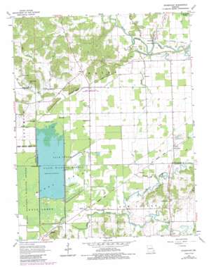
Sturdivant Topo Map Missouri
To zoom in, hover over the map of Sturdivant
USGS Topo Quad 37090a1 - 1:24,000 scale
| Topo Map Name: | Sturdivant |
| USGS Topo Quad ID: | 37090a1 |
| Print Size: | ca. 21 1/4" wide x 27" high |
| Southeast Coordinates: | 37° N latitude / 90° W longitude |
| Map Center Coordinates: | 37.0625° N latitude / 90.0625° W longitude |
| U.S. State: | MO |
| Filename: | o37090a1.jpg |
| Download Map JPG Image: | Sturdivant topo map 1:24,000 scale |
| Map Type: | Topographic |
| Topo Series: | 7.5´ |
| Map Scale: | 1:24,000 |
| Source of Map Images: | United States Geological Survey (USGS) |
| Alternate Map Versions: |
Sturdivant MO 1963, updated 1964 Download PDF Buy paper map Sturdivant MO 1963, updated 1985 Download PDF Buy paper map Sturdivant MO 2012 Download PDF Buy paper map Sturdivant MO 2015 Download PDF Buy paper map |
1:24,000 Topo Quads surrounding Sturdivant
> Back to 37090a1 at 1:100,000 scale
> Back to 37090a1 at 1:250,000 scale
> Back to U.S. Topo Maps home
Sturdivant topo map: Gazetteer
Sturdivant: Areas
Eastern Ozark Border elevation 110m 360′Sturdivant: Canals
Ditch Number 1 elevation 102m 334′Sturdivant: Cliffs
Fears Bluff elevation 131m 429′Snake Bluff elevation 114m 374′
Sturdivant: Dams
Acuff and Ayers Lake Dam elevation 140m 459′Duck Creek State Wildlife Refuge Number 1 Dam elevation 103m 337′
Duck Creek State Wildlife Refuge Number 2 Dam elevation 105m 344′
Duck Creek State Wildlife Refuge Number 3 Dam elevation 103m 337′
Mononame 468 Dam elevation 115m 377′
Strobel Lake Dam elevation 102m 334′
Ward Dam elevation 116m 380′
Sturdivant: Parks
Dark Cypress Swamp State Wildlife Area elevation 115m 377′Duck Creek Conservation Area elevation 105m 344′
Duck Creek State Wildlife Management Area elevation 106m 347′
Sturdivant: Populated Places
Arab elevation 127m 416′Arab elevation 110m 360′
Eaglette elevation 105m 344′
Greenbrier elevation 111m 364′
Idlewild elevation 105m 344′
Kinder elevation 103m 337′
Leora elevation 115m 377′
Sturdivant elevation 107m 351′
Sturdivant: Reservoirs
Acuff and Ayers Lake elevation 140m 459′Ellison Lake elevation 102m 334′
Ward Lake elevation 116m 380′
Sturdivant: Ridges
Grapevine Ridge elevation 105m 344′Sturdivant: Streams
Brush Creek elevation 105m 344′Cato Slough elevation 101m 331′
Duck Creek elevation 101m 331′
Slagle Creek elevation 104m 341′
Sturdivant: Swamps
Cato Slough elevation 115m 377′Pool Eight elevation 103m 337′
Sturdivant digital topo map on disk
Buy this Sturdivant topo map showing relief, roads, GPS coordinates and other geographical features, as a high-resolution digital map file on DVD:


