Mcgee Topo Map Missouri
To zoom in, hover over the map of Mcgee
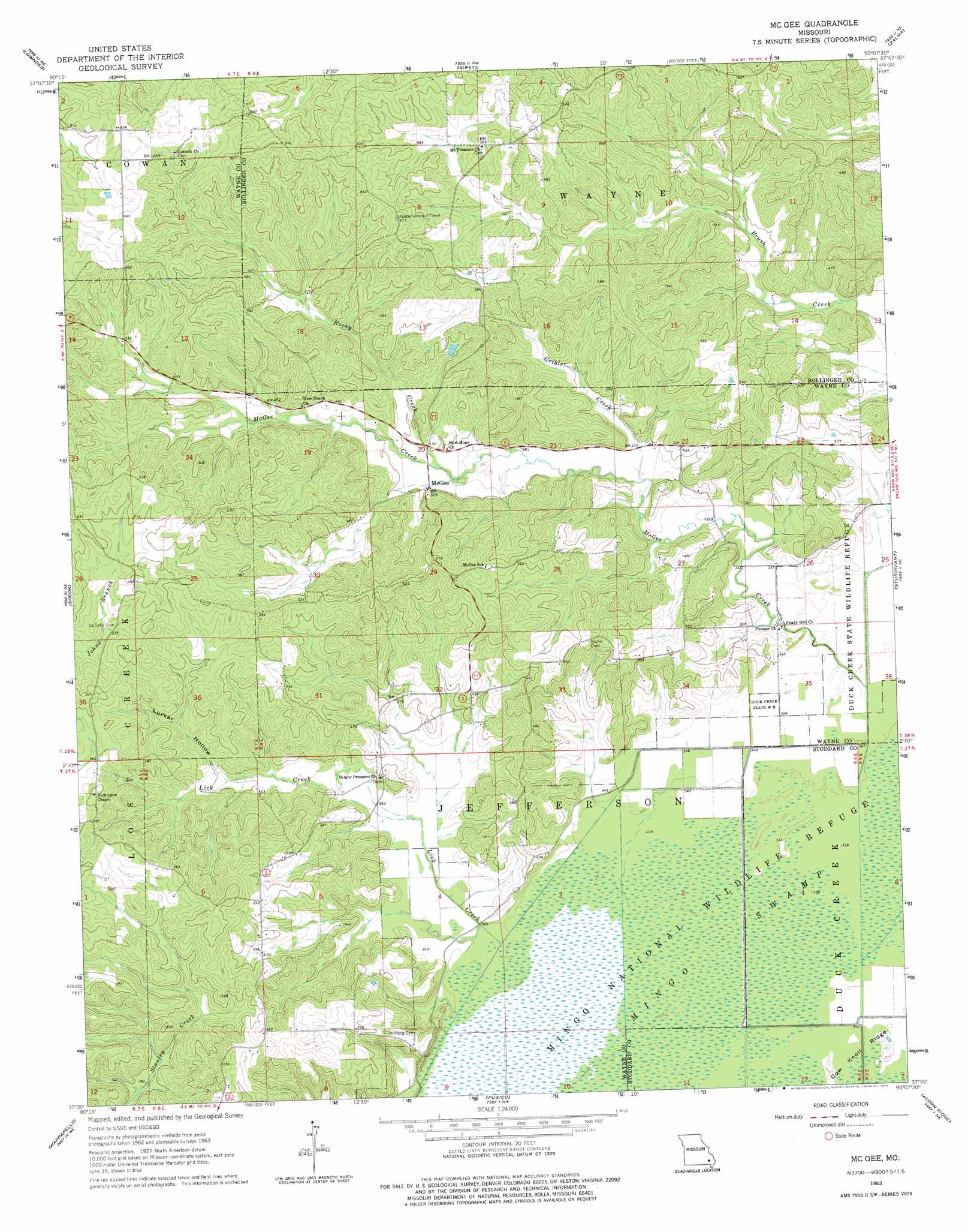
USGS Topo Quad 37090a2 - 1:24,000 scale
| Topo Map Name: | Mcgee |
| USGS Topo Quad ID: | 37090a2 |
| Print Size: | ca. 21 1/4" wide x 27" high |
| Southeast Coordinates: | 37° N latitude / 90.125° W longitude |
| Map Center Coordinates: | 37.0625° N latitude / 90.1875° W longitude |
| U.S. State: | MO |
| Filename: | o37090a2.jpg |
| Download Map JPG Image: | Mcgee topo map 1:24,000 scale |
| Map Type: | Topographic |
| Topo Series: | 7.5´ |
| Map Scale: | 1:24,000 |
| Source of Map Images: | United States Geological Survey (USGS) |
| Alternate Map Versions: |
McGee MO 1963, updated 1964 Download PDF Buy paper map McGee MO 1963, updated 1975 Download PDF Buy paper map McGee MO 2011 Download PDF Buy paper map McGee MO 2015 Download PDF Buy paper map |
1:24,000 Topo Quads surrounding Mcgee
Coldwater |
Cascade |
Allbright |
Glenallen |
Marble Hill |
Greenville |
Lowndes |
Gipsy |
Zalma |
Dongola |
Greenville Sw |
Shook |
Mcgee |
Sturdivant |
Advance |
Hendrickson |
Wappapello |
Puxico |
Acorn Ridge |
Bloomfield |
Poplar Bluff |
Rombauer |
Fisk |
Dudley |
Dexter |
> Back to 37090a1 at 1:100,000 scale
> Back to 37090a1 at 1:250,000 scale
> Back to U.S. Topo Maps home
Mcgee topo map: Gazetteer
Mcgee: Canals
Ditch Number 2 elevation 103m 337′Ditch Number 3 elevation 102m 334′
Ditch Number 4 elevation 102m 334′
Mcgee: Dams
Drum Dam elevation 133m 436′Mingo Refuge Fox Pond Dam elevation 111m 364′
Mulenex Lake Dam elevation 171m 561′
Puxico Quad Number 1 Dam elevation 104m 341′
Sweet Asylum Hollow Dam elevation 183m 600′
Mcgee: Populated Places
McGee elevation 118m 387′Mcgee: Reservoirs
Drum Lake elevation 133m 436′Fox Pond elevation 111m 364′
May Pond elevation 109m 357′
Mulenex Lake elevation 171m 561′
Sweet Asylum Hollow Lake elevation 183m 600′
Mcgee: Streams
DeCelis Branch elevation 115m 377′Gribler Creek elevation 109m 357′
Johns Branch elevation 156m 511′
Lick Creek elevation 102m 334′
McGee Creek elevation 104m 341′
Rocky Creek elevation 116m 380′
Stilts Branch elevation 104m 341′
Mcgee: Summits
Horsehead Knoll elevation 104m 341′Mcgee: Swamps
Gumstump Pool elevation 102m 334′Mingo Swamp elevation 103m 337′
Monopoly Marsh elevation 101m 331′
Mcgee: Valleys
Lurker Hollow elevation 119m 390′Manning Cabin Hollow elevation 120m 393′
Mcgee digital topo map on disk
Buy this Mcgee topo map showing relief, roads, GPS coordinates and other geographical features, as a high-resolution digital map file on DVD: