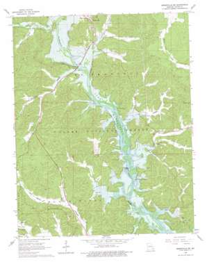
Greenville Sw Topo Map Missouri
To zoom in, hover over the map of Greenville Sw
USGS Topo Quad 37090a4 - 1:24,000 scale
| Topo Map Name: | Greenville Sw |
| USGS Topo Quad ID: | 37090a4 |
| Print Size: | ca. 21 1/4" wide x 27" high |
| Southeast Coordinates: | 37° N latitude / 90.375° W longitude |
| Map Center Coordinates: | 37.0625° N latitude / 90.4375° W longitude |
| U.S. State: | MO |
| Filename: | o37090a4.jpg |
| Download Map JPG Image: | Greenville Sw topo map 1:24,000 scale |
| Map Type: | Topographic |
| Topo Series: | 7.5´ |
| Map Scale: | 1:24,000 |
| Source of Map Images: | United States Geological Survey (USGS) |
| Alternate Map Versions: |
Greenville SW MO 1966, updated 1967 Download PDF Buy paper map Greenville SW MO 1966, updated 1976 Download PDF Buy paper map Greenville SW MO 2011 Download PDF Buy paper map Greenville SW MO 2015 Download PDF Buy paper map |
| FStopo: | US Forest Service topo Greenville SW is available: Download FStopo PDF Download FStopo TIF |
1:24,000 Topo Quads surrounding Greenville Sw
> Back to 37090a1 at 1:100,000 scale
> Back to 37090a1 at 1:250,000 scale
> Back to U.S. Topo Maps home
Greenville Sw topo map: Gazetteer
Greenville Sw: Bridges
Greenville Bridge elevation 109m 357′Greenville Sw: Cliffs
Cedar Bluff elevation 129m 423′Halls Bluff elevation 128m 419′
Greenville Sw: Parks
Old Greenville Recreation Area elevation 115m 377′Greenville Sw: Populated Places
Holliday Landing elevation 123m 403′Kime elevation 127m 416′
Old Greenville (historical) elevation 115m 377′
Greenville Sw: Ridges
Lonesome Ridge (historical) elevation 150m 492′Greenville Sw: Springs
Davidsons Blue Spring elevation 123m 403′Greenville Sw: Streams
Asher Creek elevation 109m 357′Big Lake Creek elevation 109m 357′
Caldwell Creek elevation 109m 357′
Holliday Creek elevation 109m 357′
Little Lake Creek elevation 110m 360′
Page Branch elevation 109m 357′
Greenville Sw: Summits
Flynn Hill elevation 178m 583′Lone Hill elevation 141m 462′
Greenville Sw: Trails
Johnson Natural Area Backpack Trail elevation 184m 603′Greenville Sw: Valleys
Browns Hollow elevation 116m 380′Happy Hollow elevation 110m 360′
Pleasant Valley elevation 111m 364′
Greenville Sw digital topo map on disk
Buy this Greenville Sw topo map showing relief, roads, GPS coordinates and other geographical features, as a high-resolution digital map file on DVD:


