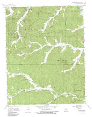
Ellington Se Topo Map Missouri
To zoom in, hover over the map of Ellington Se
USGS Topo Quad 37090a7 - 1:24,000 scale
| Topo Map Name: | Ellington Se |
| USGS Topo Quad ID: | 37090a7 |
| Print Size: | ca. 21 1/4" wide x 27" high |
| Southeast Coordinates: | 37° N latitude / 90.75° W longitude |
| Map Center Coordinates: | 37.0625° N latitude / 90.8125° W longitude |
| U.S. State: | MO |
| Filename: | o37090a7.jpg |
| Download Map JPG Image: | Ellington Se topo map 1:24,000 scale |
| Map Type: | Topographic |
| Topo Series: | 7.5´ |
| Map Scale: | 1:24,000 |
| Source of Map Images: | United States Geological Survey (USGS) |
| Alternate Map Versions: |
Ellington SE MO 1968, updated 1969 Download PDF Buy paper map Ellington SE MO 1968, updated 1983 Download PDF Buy paper map Ellington SE MO 2012 Download PDF Buy paper map Ellington SE MO 2015 Download PDF Buy paper map |
| FStopo: | US Forest Service topo Ellington SE is available: Download FStopo PDF Download FStopo TIF |
1:24,000 Topo Quads surrounding Ellington Se
> Back to 37090a1 at 1:100,000 scale
> Back to 37090a1 at 1:250,000 scale
> Back to U.S. Topo Maps home
Ellington Se topo map: Gazetteer
Ellington Se: Airports
Flying 'J' Ranch Airport elevation 229m 751′Ellington Se: Lakes
Sweazea Pond elevation 199m 652′Ellington Se: Mines
Devils Kitchen Mine elevation 249m 816′Ellington Se: Populated Places
Chilton (historical) elevation 150m 492′Hadley elevation 175m 574′
Ellington Se: Streams
Devils Run elevation 164m 538′Elm Branch elevation 176m 577′
Oak Spring Branch elevation 191m 626′
South Fork Big Brushy Creek elevation 184m 603′
Ellington Se: Summits
Bear Mountain elevation 295m 967′Ellington Se: Valleys
Clyburn Valley elevation 146m 479′Dog Hollow elevation 222m 728′
Hurricane Hollow elevation 197m 646′
Sanders Hollow elevation 201m 659′
South Fork Greenwood Valley elevation 175m 574′
Ellington Se digital topo map on disk
Buy this Ellington Se topo map showing relief, roads, GPS coordinates and other geographical features, as a high-resolution digital map file on DVD:


