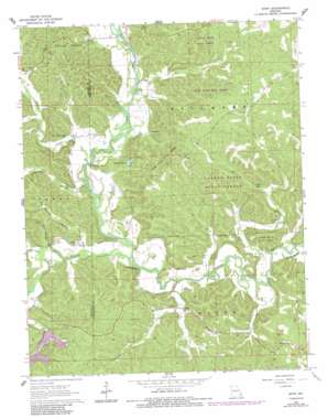
Gipsy Topo Map Missouri
To zoom in, hover over the map of Gipsy
USGS Topo Quad 37090b2 - 1:24,000 scale
| Topo Map Name: | Gipsy |
| USGS Topo Quad ID: | 37090b2 |
| Print Size: | ca. 21 1/4" wide x 27" high |
| Southeast Coordinates: | 37.125° N latitude / 90.125° W longitude |
| Map Center Coordinates: | 37.1875° N latitude / 90.1875° W longitude |
| U.S. State: | MO |
| Filename: | o37090b2.jpg |
| Download Map JPG Image: | Gipsy topo map 1:24,000 scale |
| Map Type: | Topographic |
| Topo Series: | 7.5´ |
| Map Scale: | 1:24,000 |
| Source of Map Images: | United States Geological Survey (USGS) |
| Alternate Map Versions: |
Gipsy MO 1963, updated 1964 Download PDF Buy paper map Gipsy MO 1963, updated 1973 Download PDF Buy paper map Gipsy MO 1964, updated 1985 Download PDF Buy paper map Gipsy MO 2011 Download PDF Buy paper map Gipsy MO 2015 Download PDF Buy paper map |
1:24,000 Topo Quads surrounding Gipsy
> Back to 37090a1 at 1:100,000 scale
> Back to 37090a1 at 1:250,000 scale
> Back to U.S. Topo Maps home
Gipsy topo map: Gazetteer
Gipsy: Dams
Lake Janna Dam elevation 159m 521′Lake Julia Dam elevation 159m 521′
Lake of the Pines Dam elevation 160m 524′
Turners Dream Lake Dam elevation 148m 485′
Gipsy: Forests
Castor River State Forest elevation 214m 702′Gipsy: Lakes
Blue Pond elevation 139m 456′Factory Pond elevation 136m 446′
Gipsy: Populated Places
Buchanan elevation 137m 449′Gipsy elevation 124m 406′
Gipsy: Post Offices
Choat Post Office (historical) elevation 185m 606′Gipsy: Streams
Andys Creek elevation 122m 400′Bear Creek elevation 118m 387′
Cypress Slough elevation 115m 377′
Grassy Creek elevation 128m 419′
Jesse Creek elevation 115m 377′
Lick Log Creek elevation 115m 377′
Pond Creek elevation 115m 377′
Turkey Creek elevation 121m 396′
Gipsy: Valleys
Big Branch Hollow elevation 121m 396′Hurricane Hollow elevation 118m 387′
Lime Kiln Hollow elevation 123m 403′
Gipsy digital topo map on disk
Buy this Gipsy topo map showing relief, roads, GPS coordinates and other geographical features, as a high-resolution digital map file on DVD:


