Allbright Topo Map Missouri
To zoom in, hover over the map of Allbright
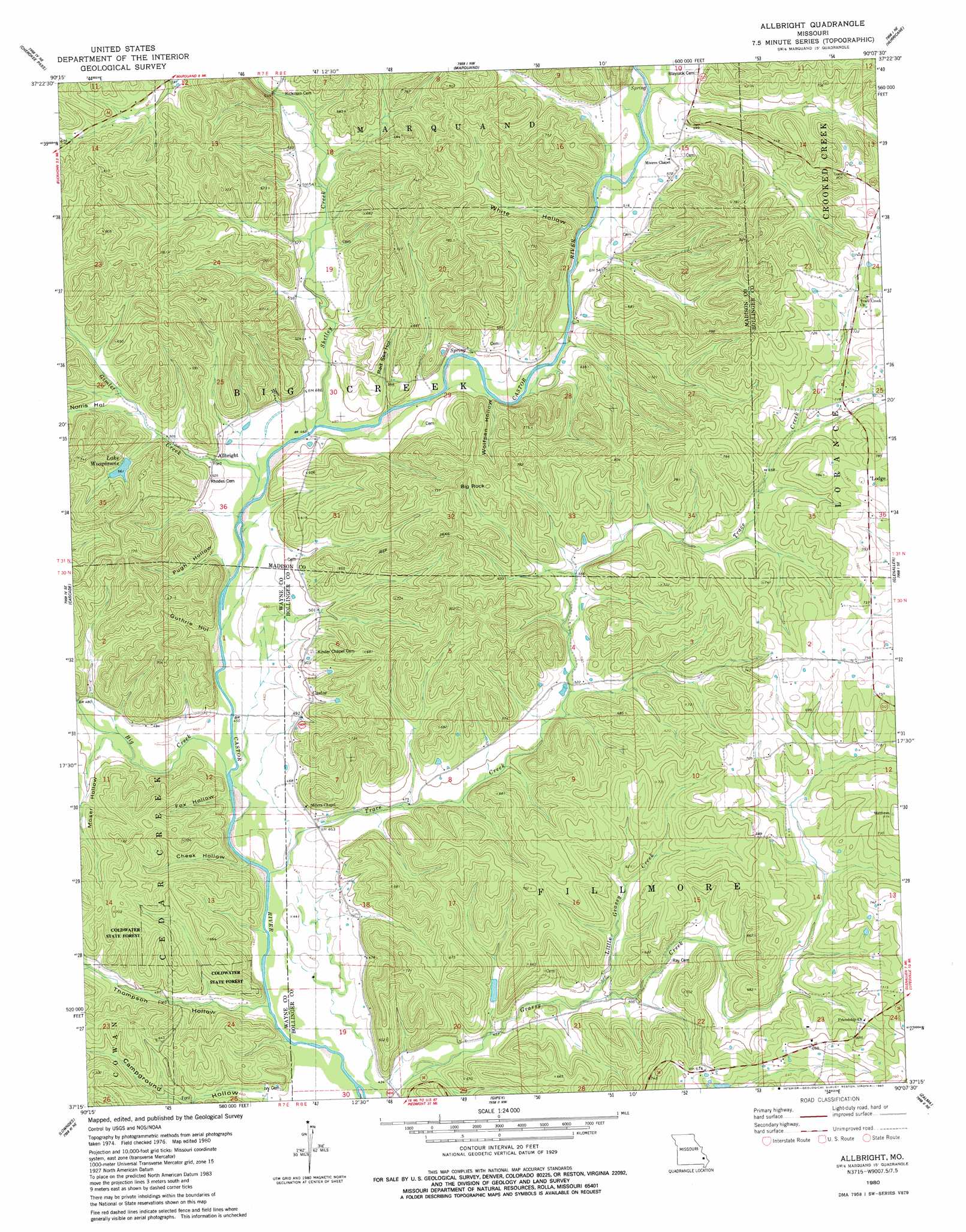
USGS Topo Quad 37090c2 - 1:24,000 scale
| Topo Map Name: | Allbright |
| USGS Topo Quad ID: | 37090c2 |
| Print Size: | ca. 21 1/4" wide x 27" high |
| Southeast Coordinates: | 37.25° N latitude / 90.125° W longitude |
| Map Center Coordinates: | 37.3125° N latitude / 90.1875° W longitude |
| U.S. State: | MO |
| Filename: | o37090c2.jpg |
| Download Map JPG Image: | Allbright topo map 1:24,000 scale |
| Map Type: | Topographic |
| Topo Series: | 7.5´ |
| Map Scale: | 1:24,000 |
| Source of Map Images: | United States Geological Survey (USGS) |
| Alternate Map Versions: |
Allbright MO 1980, updated 1980 Download PDF Buy paper map Allbright MO 2011 Download PDF Buy paper map Allbright MO 2015 Download PDF Buy paper map |
1:24,000 Topo Quads surrounding Allbright
Rhodes Mountain |
Fredericktown |
Higdon |
Patton |
Sedgewickville |
Rock Pile Mountain |
Cherokee Pass |
Marquand |
Hurricane |
Scopus |
Coldwater |
Cascade |
Allbright |
Glenallen |
Marble Hill |
Greenville |
Lowndes |
Gipsy |
Zalma |
Dongola |
Greenville Sw |
Shook |
Mcgee |
Sturdivant |
Advance |
> Back to 37090a1 at 1:100,000 scale
> Back to 37090a1 at 1:250,000 scale
> Back to U.S. Topo Maps home
Allbright topo map: Gazetteer
Allbright: Dams
Britton Lake Dam elevation 178m 583′Allbright: Populated Places
Allbright elevation 148m 485′Allbright: Reservoirs
Lake Woaplanne elevation 168m 551′Lake Wopalanne elevation 178m 583′
Allbright: Streams
Big Creek elevation 134m 439′Little Grassy Creek elevation 148m 485′
Shetley Creek elevation 142m 465′
Trace Creek elevation 131m 429′
Allbright: Summits
Big Rock elevation 245m 803′Allbright: Valleys
Campground Hollow elevation 136m 446′Cheek Hollow elevation 131m 429′
Fox Hollow elevation 134m 439′
Guthrie Hollow elevation 141m 462′
Moser Hollow elevation 140m 459′
Norris Hollow elevation 157m 515′
Pugh Hollow elevation 138m 452′
Red Sea Hollow elevation 145m 475′
Thompson Hollow elevation 129m 423′
White Hollow elevation 169m 554′
Wolfpen Hollow elevation 150m 492′
Allbright digital topo map on disk
Buy this Allbright topo map showing relief, roads, GPS coordinates and other geographical features, as a high-resolution digital map file on DVD: