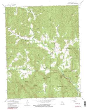
Brunot Topo Map Missouri
To zoom in, hover over the map of Brunot
USGS Topo Quad 37090c5 - 1:24,000 scale
| Topo Map Name: | Brunot |
| USGS Topo Quad ID: | 37090c5 |
| Print Size: | ca. 21 1/4" wide x 27" high |
| Southeast Coordinates: | 37.25° N latitude / 90.5° W longitude |
| Map Center Coordinates: | 37.3125° N latitude / 90.5625° W longitude |
| U.S. State: | MO |
| Filename: | o37090c5.jpg |
| Download Map JPG Image: | Brunot topo map 1:24,000 scale |
| Map Type: | Topographic |
| Topo Series: | 7.5´ |
| Map Scale: | 1:24,000 |
| Source of Map Images: | United States Geological Survey (USGS) |
| Alternate Map Versions: |
Brunot MO 1968, updated 1969 Download PDF Buy paper map Brunot MO 1968, updated 1983 Download PDF Buy paper map Brunot MO 1968, updated 1983 Download PDF Buy paper map Brunot MO 2011 Download PDF Buy paper map Brunot MO 2015 Download PDF Buy paper map |
1:24,000 Topo Quads surrounding Brunot
> Back to 37090a1 at 1:100,000 scale
> Back to 37090a1 at 1:250,000 scale
> Back to U.S. Topo Maps home
Brunot topo map: Gazetteer
Brunot: Dams
Collins Lake Section 16 Dam elevation 133m 436′Number 654 Dam elevation 186m 610′
Schultz Lake Dam elevation 188m 616′
Shy Lake Dam elevation 169m 554′
Brunot: Forests
Graves Mountain State Forest elevation 215m 705′Brunot: Mines
E W Graves Porphyry Quarry elevation 163m 534′J.S. Benson Porphyry Quarry elevation 190m 623′
Lindsey Iron Bank elevation 168m 551′
Brunot: Parks
Sam A Baker State Park elevation 281m 921′Brunot: Populated Places
Beulah elevation 164m 538′Brunot elevation 151m 495′
Brunot: Rapids
Shut-Ins elevation 143m 469′Brunot: Reservoirs
Collins Lake elevation 133m 436′Shy Dam elevation 169m 554′
Brunot: Springs
Blue Spring elevation 142m 465′Weeping Willow Spring elevation 165m 541′
Brunot: Streams
Brunot Creek elevation 140m 459′Brushy Creek elevation 152m 498′
Crane Pond Creek elevation 130m 426′
Glade Creek elevation 137m 449′
Mill Creek elevation 142m 465′
Patterson Branch elevation 130m 426′
Sulphur Creek elevation 182m 597′
Brunot: Summits
Crowley Hill elevation 275m 902′Des Arc Mountain elevation 422m 1384′
Graves Mountain elevation 312m 1023′
Green Mountain elevation 336m 1102′
Hickman Mountain elevation 287m 941′
Mudlick Mountain elevation 398m 1305′
Rocky Mountain elevation 386m 1266′
Brunot: Valleys
Cunningham Hollow elevation 181m 593′Henderson Hollow elevation 156m 511′
Mash Hollow elevation 151m 495′
McCue Hollow elevation 171m 561′
Mudlick Hollow elevation 131m 429′
Brunot digital topo map on disk
Buy this Brunot topo map showing relief, roads, GPS coordinates and other geographical features, as a high-resolution digital map file on DVD:


