Patton Topo Map Missouri
To zoom in, hover over the map of Patton
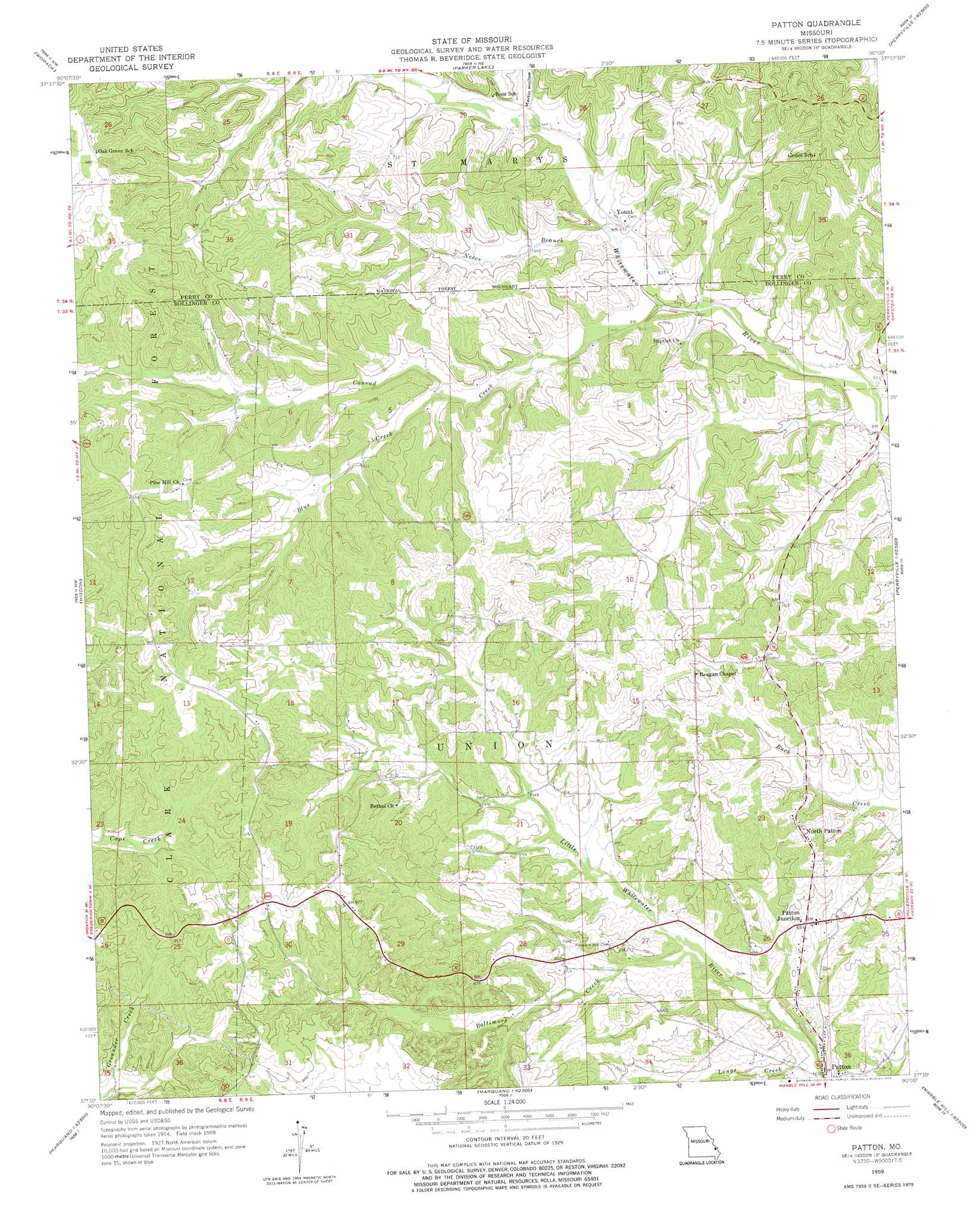
USGS Topo Quad 37090e1 - 1:24,000 scale
| Topo Map Name: | Patton |
| USGS Topo Quad ID: | 37090e1 |
| Print Size: | ca. 21 1/4" wide x 27" high |
| Southeast Coordinates: | 37.5° N latitude / 90° W longitude |
| Map Center Coordinates: | 37.5625° N latitude / 90.0625° W longitude |
| U.S. State: | MO |
| Filename: | o37090e1.jpg |
| Download Map JPG Image: | Patton topo map 1:24,000 scale |
| Map Type: | Topographic |
| Topo Series: | 7.5´ |
| Map Scale: | 1:24,000 |
| Source of Map Images: | United States Geological Survey (USGS) |
| Alternate Map Versions: |
Patton MO 1959, updated 1960 Download PDF Buy paper map Patton MO 1959, updated 1975 Download PDF Buy paper map Patton MO 2000, updated 2003 Download PDF Buy paper map Patton MO 2011 Download PDF Buy paper map Patton MO 2015 Download PDF Buy paper map |
| FStopo: | US Forest Service topo Patton is available: Download FStopo PDF Download FStopo TIF |
1:24,000 Topo Quads surrounding Patton
Sprott |
Coffman |
Minnith |
Lithium |
Belgique |
Knob Lick |
Womack |
Parker Lake |
Perryville West |
Perryville East |
Fredericktown |
Higdon |
Patton |
Sedgewickville |
Friedheim |
Cherokee Pass |
Marquand |
Hurricane |
Scopus |
Millersville |
Cascade |
Allbright |
Glenallen |
Marble Hill |
Bufordville |
> Back to 37090e1 at 1:100,000 scale
> Back to 37090a1 at 1:250,000 scale
> Back to U.S. Topo Maps home
Patton topo map: Gazetteer
Patton: Dams
Destitute Acres Lake Dam elevation 233m 764′Fulton Dam elevation 232m 761′
Grindstaff Dam elevation 206m 675′
Patton: Populated Places
Ezra (historical) elevation 269m 882′Heitmans Mill elevation 180m 590′
North Patton elevation 239m 784′
Patton elevation 189m 620′
Patton Junction elevation 208m 682′
Precinct elevation 250m 820′
Yount elevation 190m 623′
Patton: Reservoirs
Destitute Acres Lake elevation 233m 764′Fulton Lake elevation 232m 761′
Grindstaff Lake elevation 206m 675′
Patton: Streams
Baltimore Creek elevation 184m 603′Blue Creek elevation 198m 649′
Conrad Creek elevation 181m 593′
Neece Branch elevation 185m 606′
Patton: Valleys
Martin Hollow elevation 198m 649′Patton digital topo map on disk
Buy this Patton topo map showing relief, roads, GPS coordinates and other geographical features, as a high-resolution digital map file on DVD: