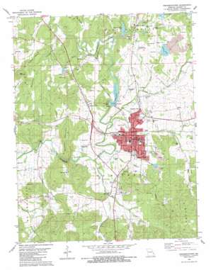
Fredericktown Topo Map Missouri
To zoom in, hover over the map of Fredericktown
USGS Topo Quad 37090e3 - 1:24,000 scale
| Topo Map Name: | Fredericktown |
| USGS Topo Quad ID: | 37090e3 |
| Print Size: | ca. 21 1/4" wide x 27" high |
| Southeast Coordinates: | 37.5° N latitude / 90.25° W longitude |
| Map Center Coordinates: | 37.5625° N latitude / 90.3125° W longitude |
| U.S. State: | MO |
| Filename: | o37090e3.jpg |
| Download Map JPG Image: | Fredericktown topo map 1:24,000 scale |
| Map Type: | Topographic |
| Topo Series: | 7.5´ |
| Map Scale: | 1:24,000 |
| Source of Map Images: | United States Geological Survey (USGS) |
| Alternate Map Versions: |
Fredericktown MO 1980, updated 1980 Download PDF Buy paper map Fredericktown MO 2011 Download PDF Buy paper map Fredericktown MO 2015 Download PDF Buy paper map |
| FStopo: | US Forest Service topo Fredericktown is available: Download FStopo PDF Download FStopo TIF |
1:24,000 Topo Quads surrounding Fredericktown
> Back to 37090e1 at 1:100,000 scale
> Back to 37090a1 at 1:250,000 scale
> Back to U.S. Topo Maps home
Fredericktown topo map: Gazetteer
Fredericktown: Airports
Fredericktown Municipal Airport elevation 268m 879′Madison Memorial Heliport elevation 224m 734′
Fredericktown: Channels
The Narrows elevation 210m 688′Fredericktown: Dams
Fredericktown City Dam elevation 213m 698′John Bollinger Number 1 Dam elevation 237m 777′
John Bollinger Number 2 Dam elevation 241m 790′
Lake Harmony Dam elevation 242m 793′
Main Tailings Dam - Anschutz elevation 264m 866′
Slime Pond Dam elevation 250m 820′
Upstream Dam elevation 269m 882′
Fredericktown: Mines
Catherine Mines elevation 286m 938′Lindsey Mine elevation 268m 879′
Offset Mine elevation 248m 813′
Old Jack Mine elevation 268m 879′
Park City Mines elevation 252m 826′
Saint Joseph Lead Mines (historical) elevation 264m 866′
Schulte Mine (historical) elevation 252m 826′
Fredericktown: Parks
City Lake Park elevation 249m 816′Fredericktown: Populated Places
Catherine Place elevation 235m 770′Cobalt Village elevation 234m 767′
Fredericktown elevation 226m 741′
Junction City elevation 226m 741′
Millcreek elevation 227m 744′
Mine La Motte elevation 245m 803′
Fredericktown: Reservoirs
City Lake elevation 213m 698′Freshwater Lake elevation 269m 882′
Lake La Motte elevation 266m 872′
Mine La Motte Dam elevation 250m 820′
Mine La Motte Lake elevation 237m 777′
Mine Lamotte Lake elevation 242m 793′
Slime Pond elevation 251m 823′
Tailings Lake elevation 264m 866′
Fredericktown: Streams
Goose Creek elevation 220m 721′Lahmeyer Creek elevation 229m 751′
Logtown Branch elevation 225m 738′
Matthew Creek elevation 216m 708′
Matthews Creek elevation 215m 705′
Mill Creek elevation 207m 679′
Musco Creek elevation 226m 741′
Plum Creek elevation 195m 639′
Saline Creek elevation 209m 685′
Shays Creek elevation 218m 715′
Slater Branch elevation 194m 636′
Spiva Branch elevation 208m 682′
Sweetwater Branch elevation 237m 777′
Tollar Branch elevation 213m 698′
Village Creek elevation 209m 685′
White Oak Springs Branch elevation 231m 757′
Fredericktown: Summits
Bald Mountain elevation 309m 1013′Buckner Mountain elevation 285m 935′
Mount Devon elevation 336m 1102′
Skrainka Hill elevation 324m 1062′
Vogel Hill elevation 321m 1053′
Fredericktown: Wells
Flowing Well elevation 230m 754′Fredericktown digital topo map on disk
Buy this Fredericktown topo map showing relief, roads, GPS coordinates and other geographical features, as a high-resolution digital map file on DVD:


