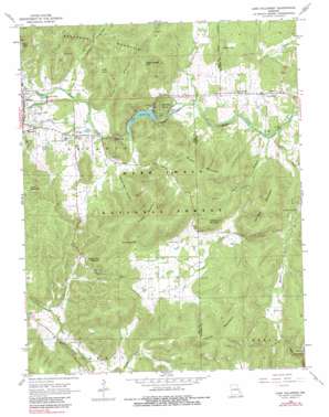
Lake Killarney Topo Map Missouri
To zoom in, hover over the map of Lake Killarney
USGS Topo Quad 37090e5 - 1:24,000 scale
| Topo Map Name: | Lake Killarney |
| USGS Topo Quad ID: | 37090e5 |
| Print Size: | ca. 21 1/4" wide x 27" high |
| Southeast Coordinates: | 37.5° N latitude / 90.5° W longitude |
| Map Center Coordinates: | 37.5625° N latitude / 90.5625° W longitude |
| U.S. State: | MO |
| Filename: | o37090e5.jpg |
| Download Map JPG Image: | Lake Killarney topo map 1:24,000 scale |
| Map Type: | Topographic |
| Topo Series: | 7.5´ |
| Map Scale: | 1:24,000 |
| Source of Map Images: | United States Geological Survey (USGS) |
| Alternate Map Versions: |
Lake Killarney MO 1968, updated 1970 Download PDF Buy paper map Lake Killarney MO 1968, updated 1983 Download PDF Buy paper map Lake Killarney MO 2000, updated 2003 Download PDF Buy paper map Lake Killarney MO 2011 Download PDF Buy paper map Lake Killarney MO 2015 Download PDF Buy paper map |
| FStopo: | US Forest Service topo Lake Killarney is available: Download FStopo PDF Download FStopo TIF |
1:24,000 Topo Quads surrounding Lake Killarney
> Back to 37090e1 at 1:100,000 scale
> Back to 37090a1 at 1:250,000 scale
> Back to U.S. Topo Maps home
Lake Killarney topo map: Gazetteer
Lake Killarney: Dams
Blue Mountain Methodist Camp Lake Dam elevation 263m 862′Lake Killarney Dam elevation 249m 816′
Lake Killarney: Gaps
Wagon Wheel Gap elevation 352m 1154′Lake Killarney: Mines
Hastings Limestone Quarry elevation 306m 1003′Russell Limestone Quarry elevation 275m 902′
Lake Killarney: Populated Places
Killarney Shores elevation 254m 833′Roselle elevation 257m 843′
Russellville elevation 287m 941′
Wilsonville elevation 282m 925′
Lake Killarney: Ranges
Saint Francois Mountains elevation 341m 1118′Lake Killarney: Rapids
Shut-Ins elevation 255m 836′Lake Killarney: Reservoirs
Blue Mountain Lake elevation 263m 862′Lake Killarney elevation 249m 816′
Lake Killarney: Springs
Sunny Slope Spring elevation 267m 875′Lake Killarney: Streams
Knob Creek elevation 267m 875′Long Gravel Branch elevation 216m 708′
Rock Creek elevation 213m 698′
Lake Killarney: Summits
Blankenship Mountain elevation 379m 1243′Brown Mountain elevation 423m 1387′
Cord Wood Hill elevation 403m 1322′
Crane Mountain elevation 382m 1253′
Grassy Mountain elevation 471m 1545′
Kelley Mountain elevation 429m 1407′
Little Knob elevation 402m 1318′
McLard Hill elevation 323m 1059′
Pilot Knob elevation 448m 1469′
Tims Mountain elevation 428m 1404′
Turkey Foot Mountain elevation 398m 1305′
Van East Mountain elevation 404m 1325′
Lake Killarney: Valleys
Barren Hollow elevation 246m 807′Devils Den Hollow elevation 266m 872′
Froe Hollow elevation 267m 875′
Ironton Hollow elevation 269m 882′
Lake Killarney digital topo map on disk
Buy this Lake Killarney topo map showing relief, roads, GPS coordinates and other geographical features, as a high-resolution digital map file on DVD:


