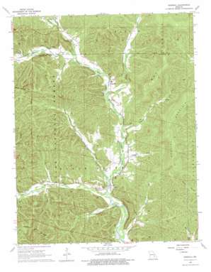
Edgehill Topo Map Missouri
To zoom in, hover over the map of Edgehill
USGS Topo Quad 37090e8 - 1:24,000 scale
| Topo Map Name: | Edgehill |
| USGS Topo Quad ID: | 37090e8 |
| Print Size: | ca. 21 1/4" wide x 27" high |
| Southeast Coordinates: | 37.5° N latitude / 90.875° W longitude |
| Map Center Coordinates: | 37.5625° N latitude / 90.9375° W longitude |
| U.S. State: | MO |
| Filename: | o37090e8.jpg |
| Download Map JPG Image: | Edgehill topo map 1:24,000 scale |
| Map Type: | Topographic |
| Topo Series: | 7.5´ |
| Map Scale: | 1:24,000 |
| Source of Map Images: | United States Geological Survey (USGS) |
| Alternate Map Versions: |
Edgehill MO 1968, updated 1969 Download PDF Buy paper map Edgehill MO 1968, updated 1977 Download PDF Buy paper map Edgehill MO 1999, updated 2002 Download PDF Buy paper map Edgehill MO 2012 Download PDF Buy paper map Edgehill MO 2015 Download PDF Buy paper map |
| FStopo: | US Forest Service topo Edgehill is available: Download FStopo PDF Download FStopo TIF |
1:24,000 Topo Quads surrounding Edgehill
> Back to 37090e1 at 1:100,000 scale
> Back to 37090a1 at 1:250,000 scale
> Back to U.S. Topo Maps home
Edgehill topo map: Gazetteer
Edgehill: Populated Places
Black elevation 244m 800′Edgehill elevation 256m 839′
Edgehill: Streams
Brushy Creek elevation 228m 748′Carty Branch elevation 227m 744′
Clayton Creek elevation 267m 875′
Little Brushy Creek elevation 229m 751′
Long Branch elevation 225m 738′
Ottery Creek elevation 246m 807′
Padfield Branch elevation 238m 780′
Strother Creek elevation 257m 843′
Edgehill: Summits
Goggins Mountain elevation 452m 1482′Edgehill: Valleys
Cash Hollow elevation 248m 813′Goggins Hollow elevation 236m 774′
Town Hollow elevation 259m 849′
Edgehill digital topo map on disk
Buy this Edgehill topo map showing relief, roads, GPS coordinates and other geographical features, as a high-resolution digital map file on DVD:


