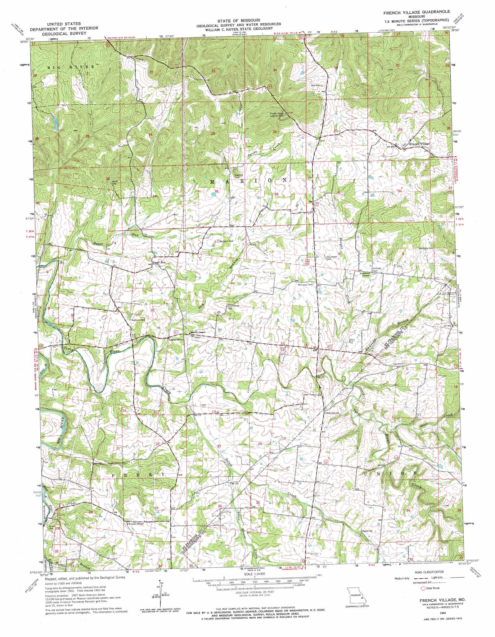
French Village Topo Map Missouri
To zoom in, hover over the map of French Village
USGS Topo Quad 37090h4 - 1:24,000 scale
| Topo Map Name: | French Village |
| USGS Topo Quad ID: | 37090h4 |
| Print Size: | ca. 21 1/4" wide x 27" high |
| Southeast Coordinates: | 37.875° N latitude / 90.375° W longitude |
| Map Center Coordinates: | 37.9375° N latitude / 90.4375° W longitude |
| U.S. State: | MO |
| Filename: | o37090h4.jpg |
| Download Map JPG Image: | French Village topo map 1:24,000 scale |
| Map Type: | Topographic |
| Topo Series: | 7.5´ |
| Map Scale: | 1:24,000 |
| Source of Map Images: | United States Geological Survey (USGS) |
| Alternate Map Versions: |
French Village MO 1964, updated 1965 Download PDF Buy paper map French Village MO 1964, updated 1969 Download PDF Buy paper map French Village MO 2011 Download PDF Buy paper map French Village MO 2015 Download PDF Buy paper map |
1:24,000 Topo Quads surrounding French Village
Fletcher |
Desoto |
Festus |
Selma |
Renault |
Tiff |
Vineland |
Halifax |
Danby |
Bloomsdale |
Mineral Point |
Bonne Terre |
French Village |
Lawrenceton |
Weingarten |
Irondale |
Flat River |
Farmington |
Sprott |
Coffman |
Graniteville |
Iron Mountain Lake |
Wachita Mountain |
Knob Lick |
Womack |
> Back to 37090e1 at 1:100,000 scale
> Back to 37090a1 at 1:250,000 scale
> Back to U.S. Topo Maps home
French Village topo map: Gazetteer
French Village: Dams
Sporich Lake Dam elevation 256m 839′Sullivan Lake Dam elevation 249m 816′
Wells Lake Dam elevation 271m 889′
French Village: Mines
Potosi Lead Diggings (historical) elevation 296m 971′French Village: Populated Places
French Village elevation 274m 898′Hazel Run elevation 240m 787′
French Village: Ranges
Pike Run Hills elevation 336m 1102′French Village: Reservoirs
Wells Lake elevation 271m 889′French Village: Streams
Andrews Branch elevation 227m 744′Bear Creek elevation 231m 757′
Bouyer Creek elevation 226m 741′
Cedar Falls Branch elevation 213m 698′
Cedar Run elevation 200m 656′
Dry Branch elevation 210m 688′
Flat River elevation 201m 659′
Hazel Run elevation 200m 656′
Jacobs Creek elevation 225m 738′
Salem Creek elevation 214m 702′
Three Rivers Creek elevation 227m 744′
Walker Branch elevation 208m 682′
French Village digital topo map on disk
Buy this French Village topo map showing relief, roads, GPS coordinates and other geographical features, as a high-resolution digital map file on DVD: