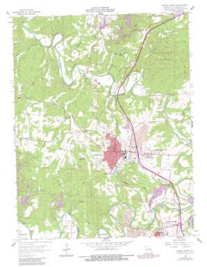
Bonne Terre Topo Map Missouri
To zoom in, hover over the map of Bonne Terre
USGS Topo Quad 37090h5 - 1:24,000 scale
| Topo Map Name: | Bonne Terre |
| USGS Topo Quad ID: | 37090h5 |
| Print Size: | ca. 21 1/4" wide x 27" high |
| Southeast Coordinates: | 37.875° N latitude / 90.5° W longitude |
| Map Center Coordinates: | 37.9375° N latitude / 90.5625° W longitude |
| U.S. State: | MO |
| Filename: | o37090h5.jpg |
| Download Map JPG Image: | Bonne Terre topo map 1:24,000 scale |
| Map Type: | Topographic |
| Topo Series: | 7.5´ |
| Map Scale: | 1:24,000 |
| Source of Map Images: | United States Geological Survey (USGS) |
| Alternate Map Versions: |
Bonne Terre MO 1958, updated 1959 Download PDF Buy paper map Bonne Terre MO 1958, updated 1973 Download PDF Buy paper map Bonne Terre MO 1958, updated 1982 Download PDF Buy paper map Bonne Terre MO 1958, updated 1982 Download PDF Buy paper map Bonne Terre MO 2011 Download PDF Buy paper map Bonne Terre MO 2015 Download PDF Buy paper map |
1:24,000 Topo Quads surrounding Bonne Terre
> Back to 37090e1 at 1:100,000 scale
> Back to 37090a1 at 1:250,000 scale
> Back to U.S. Topo Maps home
Bonne Terre topo map: Gazetteer
Bonne Terre: Airports
Bonne Terre Municipal Airport (historical) elevation 253m 830′Bonne Terre: Dams
Bee Run Lake Number 1 Dam elevation 218m 715′Bee Run Lake Number 2 Dam elevation 213m 698′
Bee Run Lake Number 3 Dam elevation 212m 695′
Bonne Aqua Lake Dam elevation 232m 761′
Cedar Lake Dam elevation 225m 738′
Goff Springs Dam elevation 223m 731′
Lac Benet Dam elevation 267m 875′
Lac Calista Dam elevation 239m 784′
Lac Emerald Dam elevation 231m 757′
Lac Lafitte Dam elevation 232m 761′
Lac Marseilles Dam elevation 240m 787′
Lac Renee Dam elevation 292m 958′
Lake Primrose Dam elevation 246m 807′
Lake Timberline Dam elevation 240m 787′
Lakeview Park Dam elevation 263m 862′
McDowell Lake Dam elevation 237m 777′
P J Bass Lake Dam elevation 240m 787′
Welshmans Lake Dam elevation 245m 803′
Bonne Terre: Mines
Dolomite Mines elevation 222m 728′La Grave Mines (historical) elevation 246m 807′
Manchester Lead Diggings (historical) elevation 218m 715′
Bonne Terre: Parks
Saint Francois State Park elevation 231m 757′Bonne Terre: Populated Places
Bonne Terre elevation 251m 823′East Bonne Terre elevation 226m 741′
Highley Heights elevation 238m 780′
Hoffman Junction elevation 281m 921′
Settletown elevation 245m 803′
Silver Springs elevation 247m 810′
The Lead Belt elevation 250m 820′
Bonne Terre: Reservoirs
Bonne Aqua Lake elevation 232m 761′Cedar Lake elevation 225m 738′
Goff Spring Lake elevation 223m 731′
Lac Benet Lake elevation 267m 875′
Lac Calista elevation 239m 784′
Lac Emerald elevation 231m 757′
Lac Marseilles elevation 240m 787′
Lac Renee elevation 292m 958′
Lake Primrose elevation 246m 807′
Lake Timberline elevation 238m 780′
Lakeview Park Lake elevation 263m 862′
P J Bass Lake elevation 240m 787′
Welshmans Lake elevation 245m 803′
Bonne Terre: Springs
Goff Spring elevation 234m 767′Rattlesnake Spring elevation 225m 738′
Bonne Terre: Streams
Bear Creek elevation 180m 590′Bee Run elevation 187m 613′
Cabanne Course elevation 183m 600′
Coonville Creek elevation 189m 620′
Number Seven Creek elevation 212m 695′
Pike Run elevation 214m 702′
Primrose Creek elevation 184m 603′
Terre Bleue Creek elevation 194m 636′
Three Hill Creek elevation 180m 590′
Turkey Creek elevation 187m 613′
Bonne Terre: Summits
Murrill Hill elevation 245m 803′Bonne Terre digital topo map on disk
Buy this Bonne Terre topo map showing relief, roads, GPS coordinates and other geographical features, as a high-resolution digital map file on DVD:


