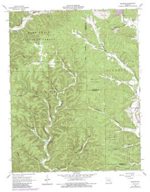
Midridge Topo Map Missouri
To zoom in, hover over the map of Midridge
USGS Topo Quad 37091c2 - 1:24,000 scale
| Topo Map Name: | Midridge |
| USGS Topo Quad ID: | 37091c2 |
| Print Size: | ca. 21 1/4" wide x 27" high |
| Southeast Coordinates: | 37.25° N latitude / 91.125° W longitude |
| Map Center Coordinates: | 37.3125° N latitude / 91.1875° W longitude |
| U.S. State: | MO |
| Filename: | o37091c2.jpg |
| Download Map JPG Image: | Midridge topo map 1:24,000 scale |
| Map Type: | Topographic |
| Topo Series: | 7.5´ |
| Map Scale: | 1:24,000 |
| Source of Map Images: | United States Geological Survey (USGS) |
| Alternate Map Versions: |
Midridge MO 1966, updated 1968 Download PDF Buy paper map Midridge MO 1966, updated 1983 Download PDF Buy paper map Midridge MO 1966, updated 1985 Download PDF Buy paper map Midridge MO 2012 Download PDF Buy paper map Midridge MO 2015 Download PDF Buy paper map |
| FStopo: | US Forest Service topo Midridge is available: Download FStopo PDF Download FStopo TIF |
1:24,000 Topo Quads surrounding Midridge
> Back to 37091a1 at 1:100,000 scale
> Back to 37090a1 at 1:250,000 scale
> Back to U.S. Topo Maps home
Midridge topo map: Gazetteer
Midridge: Capes
Cedar Point elevation 281m 921′Midridge: Dams
Ozark Lead Tailings Dam elevation 315m 1033′Midridge: Mines
Adair Creek Mine elevation 360m 1181′Midridge: Populated Places
Himont (historical) elevation 372m 1220′Midridge elevation 373m 1223′
Rat elevation 290m 951′
Midridge: Reservoirs
Number 51 Lake elevation 315m 1033′Midridge: Springs
Alec Spring elevation 257m 843′Laxton Spring elevation 279m 915′
McIntire Spring elevation 242m 793′
Spout Spring elevation 236m 774′
Swiney Spring elevation 292m 958′
Midridge: Streams
Bounds Branch elevation 288m 944′Homing Creek elevation 299m 980′
Jims Creek elevation 237m 777′
McIntire Spring Branch elevation 243m 797′
Suses Branch elevation 271m 889′
Midridge: Valleys
Alec Hollow elevation 245m 803′Barton Hollow elevation 272m 892′
Cave Hollow elevation 257m 843′
Cheney Hollow elevation 232m 761′
Graveyard Hollow elevation 260m 853′
Laxton Hollow elevation 253m 830′
Rivers Hollow elevation 291m 954′
Spring Hollow elevation 231m 757′
Woods Hollow elevation 228m 748′
Midridge digital topo map on disk
Buy this Midridge topo map showing relief, roads, GPS coordinates and other geographical features, as a high-resolution digital map file on DVD:


