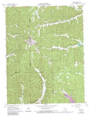
Bunker Topo Map Missouri
To zoom in, hover over the map of Bunker
USGS Topo Quad 37091d2 - 1:24,000 scale
| Topo Map Name: | Bunker |
| USGS Topo Quad ID: | 37091d2 |
| Print Size: | ca. 21 1/4" wide x 27" high |
| Southeast Coordinates: | 37.375° N latitude / 91.125° W longitude |
| Map Center Coordinates: | 37.4375° N latitude / 91.1875° W longitude |
| U.S. State: | MO |
| Filename: | o37091d2.jpg |
| Download Map JPG Image: | Bunker topo map 1:24,000 scale |
| Map Type: | Topographic |
| Topo Series: | 7.5´ |
| Map Scale: | 1:24,000 |
| Source of Map Images: | United States Geological Survey (USGS) |
| Alternate Map Versions: |
Bunker MO 1967, updated 1968 Download PDF Buy paper map Bunker MO 1967, updated 1977 Download PDF Buy paper map Bunker MO 1967, updated 1985 Download PDF Buy paper map Bunker MO 1999, updated 2002 Download PDF Buy paper map Bunker MO 2012 Download PDF Buy paper map Bunker MO 2015 Download PDF Buy paper map |
| FStopo: | US Forest Service topo Bunker is available: Download FStopo PDF Download FStopo TIF |
1:24,000 Topo Quads surrounding Bunker
> Back to 37091a1 at 1:100,000 scale
> Back to 37090a1 at 1:250,000 scale
> Back to U.S. Topo Maps home
Bunker topo map: Gazetteer
Bunker: Bridges
Turner Natural Bridge elevation 319m 1046′Bunker: Dams
Roy Davis Dam elevation 334m 1095′Bunker: Populated Places
Bunker elevation 425m 1394′Melton elevation 402m 1318′
West Bunker elevation 413m 1354′
Bunker: Reservoirs
Roy Davis Lake elevation 334m 1095′Bunker: Streams
Bills Creek elevation 287m 941′Bunker: Summits
Red Hill elevation 410m 1345′Bunker: Valleys
Jayhawker Hollow elevation 324m 1062′Ottaway Hollow elevation 326m 1069′
Bunker digital topo map on disk
Buy this Bunker topo map showing relief, roads, GPS coordinates and other geographical features, as a high-resolution digital map file on DVD:


