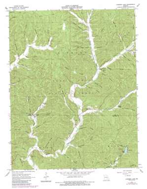
Loggers Lake Topo Map Missouri
To zoom in, hover over the map of Loggers Lake
USGS Topo Quad 37091d3 - 1:24,000 scale
| Topo Map Name: | Loggers Lake |
| USGS Topo Quad ID: | 37091d3 |
| Print Size: | ca. 21 1/4" wide x 27" high |
| Southeast Coordinates: | 37.375° N latitude / 91.25° W longitude |
| Map Center Coordinates: | 37.4375° N latitude / 91.3125° W longitude |
| U.S. State: | MO |
| Filename: | o37091d3.jpg |
| Download Map JPG Image: | Loggers Lake topo map 1:24,000 scale |
| Map Type: | Topographic |
| Topo Series: | 7.5´ |
| Map Scale: | 1:24,000 |
| Source of Map Images: | United States Geological Survey (USGS) |
| Alternate Map Versions: |
Loggers Lake MO 1967, updated 1969 Download PDF Buy paper map Loggers Lake MO 1967, updated 1984 Download PDF Buy paper map Loggers Lake MO 1967, updated 1985 Download PDF Buy paper map Loggers Lake MO 1999, updated 2002 Download PDF Buy paper map Loggers Lake MO 2012 Download PDF Buy paper map Loggers Lake MO 2015 Download PDF Buy paper map |
| FStopo: | US Forest Service topo Loggers Lake is available: Download FStopo PDF Download FStopo TIF |
1:24,000 Topo Quads surrounding Loggers Lake
> Back to 37091a1 at 1:100,000 scale
> Back to 37090a1 at 1:250,000 scale
> Back to U.S. Topo Maps home
Loggers Lake topo map: Gazetteer
Loggers Lake: Dams
Loggers Lake Dam elevation 311m 1020′Loggers Lake: Lakes
Brooks Pond elevation 420m 1377′Loggers Lake: Parks
Sinkin Experimental Forest elevation 379m 1243′Loggers Lake: Populated Places
Falk Mill (historical) elevation 294m 964′Gila elevation 288m 944′
Loggers Lake: Reservoirs
Loggers Lake elevation 311m 1020′Loggers Lake: Springs
Highley Spring elevation 305m 1000′Sugar Tree Grove Spring elevation 297m 974′
Loggers Lake: Streams
Gordon Creek elevation 296m 971′Little Creek elevation 249m 816′
Little Sinking Creek elevation 272m 892′
Loggers Lake: Valleys
Aunt Sal Hollow elevation 260m 853′Backbone Hollow elevation 266m 872′
Bacon Hollow elevation 327m 1072′
Barren Fork Hollow elevation 314m 1030′
Barxtel Hollow elevation 273m 895′
Bay Hollow elevation 326m 1069′
Bear Pen Hollow elevation 315m 1033′
Big Hollow elevation 249m 816′
Black Henry Hollow elevation 317m 1040′
Boardinghouse Hollow elevation 272m 892′
Burrus Hollow elevation 298m 977′
Burrus Hollow elevation 274m 898′
Cave Branch Hollow elevation 268m 879′
Chatman Hollow elevation 317m 1040′
Copeland Hollow elevation 333m 1092′
Dead Horse Hollow elevation 320m 1049′
Dennie Hollow elevation 287m 941′
Falk Mill Hollow elevation 291m 954′
Flat Hollow elevation 339m 1112′
Gordon Hollow elevation 325m 1066′
Hellums Hollow elevation 299m 980′
Hickory Hollow elevation 268m 879′
Hulsey Hollow elevation 327m 1072′
Improvement Hollow elevation 298m 977′
Middle Hollow elevation 294m 964′
Minninghaw Hollow elevation 347m 1138′
Nash Hollow elevation 318m 1043′
Parks Hollow elevation 329m 1079′
Pea Vine Hollow elevation 262m 859′
Red Hill Hollow elevation 323m 1059′
Ritter Hollow elevation 334m 1095′
Roney Hollow elevation 322m 1056′
Savage Hollow elevation 302m 990′
Schoolhouse Hollow elevation 255m 836′
Schoolhouse Hollow elevation 321m 1053′
Smokehouse Hollow elevation 286m 938′
Spring Hollow elevation 293m 961′
Stephens Hollow elevation 311m 1020′
Thompson Hollow elevation 265m 869′
Turkey Roost Hollow elevation 267m 875′
Loggers Lake digital topo map on disk
Buy this Loggers Lake topo map showing relief, roads, GPS coordinates and other geographical features, as a high-resolution digital map file on DVD:


