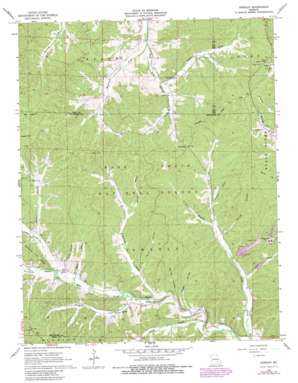
Greeley Topo Map Missouri
To zoom in, hover over the map of Greeley
USGS Topo Quad 37091e2 - 1:24,000 scale
| Topo Map Name: | Greeley |
| USGS Topo Quad ID: | 37091e2 |
| Print Size: | ca. 21 1/4" wide x 27" high |
| Southeast Coordinates: | 37.5° N latitude / 91.125° W longitude |
| Map Center Coordinates: | 37.5625° N latitude / 91.1875° W longitude |
| U.S. State: | MO |
| Filename: | o37091e2.jpg |
| Download Map JPG Image: | Greeley topo map 1:24,000 scale |
| Map Type: | Topographic |
| Topo Series: | 7.5´ |
| Map Scale: | 1:24,000 |
| Source of Map Images: | United States Geological Survey (USGS) |
| Alternate Map Versions: |
Greeley MO 1967, updated 1968 Download PDF Buy paper map Greeley MO 1967, updated 1978 Download PDF Buy paper map Greeley MO 1967, updated 1981 Download PDF Buy paper map Greeley MO 1999, updated 2002 Download PDF Buy paper map Greeley MO 2012 Download PDF Buy paper map Greeley MO 2015 Download PDF Buy paper map |
| FStopo: | US Forest Service topo Greeley is available: Download FStopo PDF Download FStopo TIF |
1:24,000 Topo Quads surrounding Greeley
> Back to 37091e1 at 1:100,000 scale
> Back to 37090a1 at 1:250,000 scale
> Back to U.S. Topo Maps home
Greeley topo map: Gazetteer
Greeley: Dams
Brushy Creek Mill Reservoir Dam elevation 381m 1250′Brushy Creek Mine Water Clarification Dam elevation 343m 1125′
Brushy Creek Tailings Dam elevation 325m 1066′
Greeley: Gaps
Low Gap elevation 390m 1279′Greeley: Mines
Brushy Creek Mine elevation 381m 1250′Brushy Creek Mine elevation 378m 1240′
Greeley: Populated Places
Buick elevation 440m 1443′Greeley elevation 308m 1010′
Greeley: Reservoirs
Brushy Creek Mine Water Lake elevation 343m 1125′Number 48 Lake elevation 381m 1250′
Greeley: Streams
Asher Creek elevation 335m 1099′Bucksnort Fork elevation 325m 1066′
Crossville Branch elevation 322m 1056′
Henpeck Creek elevation 305m 1000′
Lick Creek elevation 302m 990′
McMurtrey Creek elevation 303m 994′
Moore Branch elevation 315m 1033′
Parker Branch elevation 329m 1079′
Radford Branch elevation 322m 1056′
Smalls Creek elevation 293m 961′
Spring Branch elevation 313m 1026′
Stricklin Branch elevation 315m 1033′
Sugar Creek elevation 329m 1079′
Greeley: Valleys
Hodge Hollow elevation 299m 980′Jones Hollow elevation 325m 1066′
Spring Hollow elevation 301m 987′
Tarpit Hollow elevation 315m 1033′
Walnut Hollow elevation 328m 1076′
Warren Valley elevation 338m 1108′
Greeley digital topo map on disk
Buy this Greeley topo map showing relief, roads, GPS coordinates and other geographical features, as a high-resolution digital map file on DVD:


