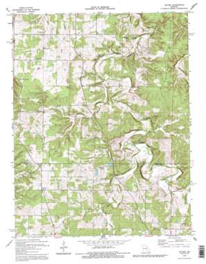
Lecoma Topo Map Missouri
To zoom in, hover over the map of Lecoma
USGS Topo Quad 37091g6 - 1:24,000 scale
| Topo Map Name: | Lecoma |
| USGS Topo Quad ID: | 37091g6 |
| Print Size: | ca. 21 1/4" wide x 27" high |
| Southeast Coordinates: | 37.75° N latitude / 91.625° W longitude |
| Map Center Coordinates: | 37.8125° N latitude / 91.6875° W longitude |
| U.S. State: | MO |
| Filename: | o37091g6.jpg |
| Download Map JPG Image: | Lecoma topo map 1:24,000 scale |
| Map Type: | Topographic |
| Topo Series: | 7.5´ |
| Map Scale: | 1:24,000 |
| Source of Map Images: | United States Geological Survey (USGS) |
| Alternate Map Versions: |
Lecoma MO 1963, updated 1964 Download PDF Buy paper map Lecoma MO 1963, updated 1985 Download PDF Buy paper map Lecoma MO 1992, updated 1995 Download PDF Buy paper map Lecoma MO 2012 Download PDF Buy paper map Lecoma MO 2015 Download PDF Buy paper map |
1:24,000 Topo Quads surrounding Lecoma
> Back to 37091e1 at 1:100,000 scale
> Back to 37090a1 at 1:250,000 scale
> Back to U.S. Topo Maps home
Lecoma topo map: Gazetteer
Lecoma: Airports
Bubbling Springs Landing Strip elevation 339m 1112′Lecoma: Areas
Elk Prairie elevation 346m 1135′Lecoma: Dams
Bubbling Springs Dam elevation 325m 1066′Highway Lake Dam elevation 314m 1030′
Lecoma: Mines
Coppage Bank elevation 313m 1026′Lecoma: Populated Places
Hobson elevation 340m 1115′Lake Spring elevation 301m 987′
Lecoma elevation 358m 1174′
Lecoma: Reservoirs
Fabick Lake elevation 325m 1066′Highway Lake elevation 314m 1030′
Lecoma: Ridges
Schuman Ridge elevation 329m 1079′Lecoma: Springs
Bell Spring elevation 285m 935′Wilson Spring elevation 279m 915′
Lecoma: Streams
Hyer Branch elevation 289m 948′Hyer Branch elevation 289m 948′
Peters Branch elevation 289m 948′
Ragan Branch elevation 280m 918′
Lecoma digital topo map on disk
Buy this Lecoma topo map showing relief, roads, GPS coordinates and other geographical features, as a high-resolution digital map file on DVD:


