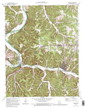
Newburg Topo Map Missouri
To zoom in, hover over the map of Newburg
USGS Topo Quad 37091h8 - 1:24,000 scale
| Topo Map Name: | Newburg |
| USGS Topo Quad ID: | 37091h8 |
| Print Size: | ca. 21 1/4" wide x 27" high |
| Southeast Coordinates: | 37.875° N latitude / 91.875° W longitude |
| Map Center Coordinates: | 37.9375° N latitude / 91.9375° W longitude |
| U.S. State: | MO |
| Filename: | o37091h8.jpg |
| Download Map JPG Image: | Newburg topo map 1:24,000 scale |
| Map Type: | Topographic |
| Topo Series: | 7.5´ |
| Map Scale: | 1:24,000 |
| Source of Map Images: | United States Geological Survey (USGS) |
| Alternate Map Versions: |
Newburg MO 1950, updated 1957 Download PDF Buy paper map Newburg MO 1950, updated 1973 Download PDF Buy paper map Newburg MO 1950, updated 1977 Download PDF Buy paper map Newburg MO 1950, updated 1985 Download PDF Buy paper map Newburg MO 1951, updated 1951 Download PDF Buy paper map Newburg MO 1980, updated 1981 Download PDF Buy paper map Newburg MO 1992, updated 1995 Download PDF Buy paper map Newburg MO 2004, updated 2006 Download PDF Buy paper map Newburg MO 2012 Download PDF Buy paper map Newburg MO 2015 Download PDF Buy paper map |
| FStopo: | US Forest Service topo Newburg is available: Download FStopo PDF Download FStopo TIF |
1:24,000 Topo Quads surrounding Newburg
> Back to 37091e1 at 1:100,000 scale
> Back to 37090a1 at 1:250,000 scale
> Back to U.S. Topo Maps home
Newburg topo map: Gazetteer
Newburg: Crossings
Whitehouse Ferry (historical) elevation 199m 652′Newburg: Dams
Affolter Lake Dam elevation 230m 754′Martin Lake Dam elevation 279m 915′
Newburg: Mines
Lead Prospect elevation 275m 902′Newburg: Parks
Alhambra Grotto Recreation Park (historical) elevation 296m 971′Newburg: Populated Places
Arlington elevation 215m 705′Doolittle elevation 306m 1003′
Jerome elevation 216m 708′
Newburg elevation 218m 715′
Sugartree elevation 208m 682′
Table Rock elevation 276m 905′
Westcott (historical) elevation 287m 941′
Newburg: Reservoirs
Affolter Lake elevation 230m 754′Arlington Lake elevation 205m 672′
Martin Reservoir elevation 279m 915′
Stony Dell Swimming Pool (historical) elevation 210m 688′
Newburg: Ridges
Devils Backbone elevation 299m 980′Newburg: Springs
Roluf Spring elevation 230m 754′Newburg: Streams
Duncan Creek elevation 198m 649′Little Piney Creek elevation 205m 672′
Mill Creek elevation 207m 679′
Mungy Branch elevation 206m 675′
Wagner Branch elevation 215m 705′
Newburg: Valleys
Brick House Hollow elevation 201m 659′Fable Hollow elevation 226m 741′
Glover Hollow elevation 211m 692′
Merrill Hollow elevation 221m 725′
Poole Hollow elevation 217m 711′
Roderick Hollow elevation 222m 728′
Smith Hollow elevation 216m 708′
Sugartree Hollow elevation 204m 669′
Tater Hollow elevation 207m 679′
Yates Hollow elevation 237m 777′
Newburg digital topo map on disk
Buy this Newburg topo map showing relief, roads, GPS coordinates and other geographical features, as a high-resolution digital map file on DVD:


