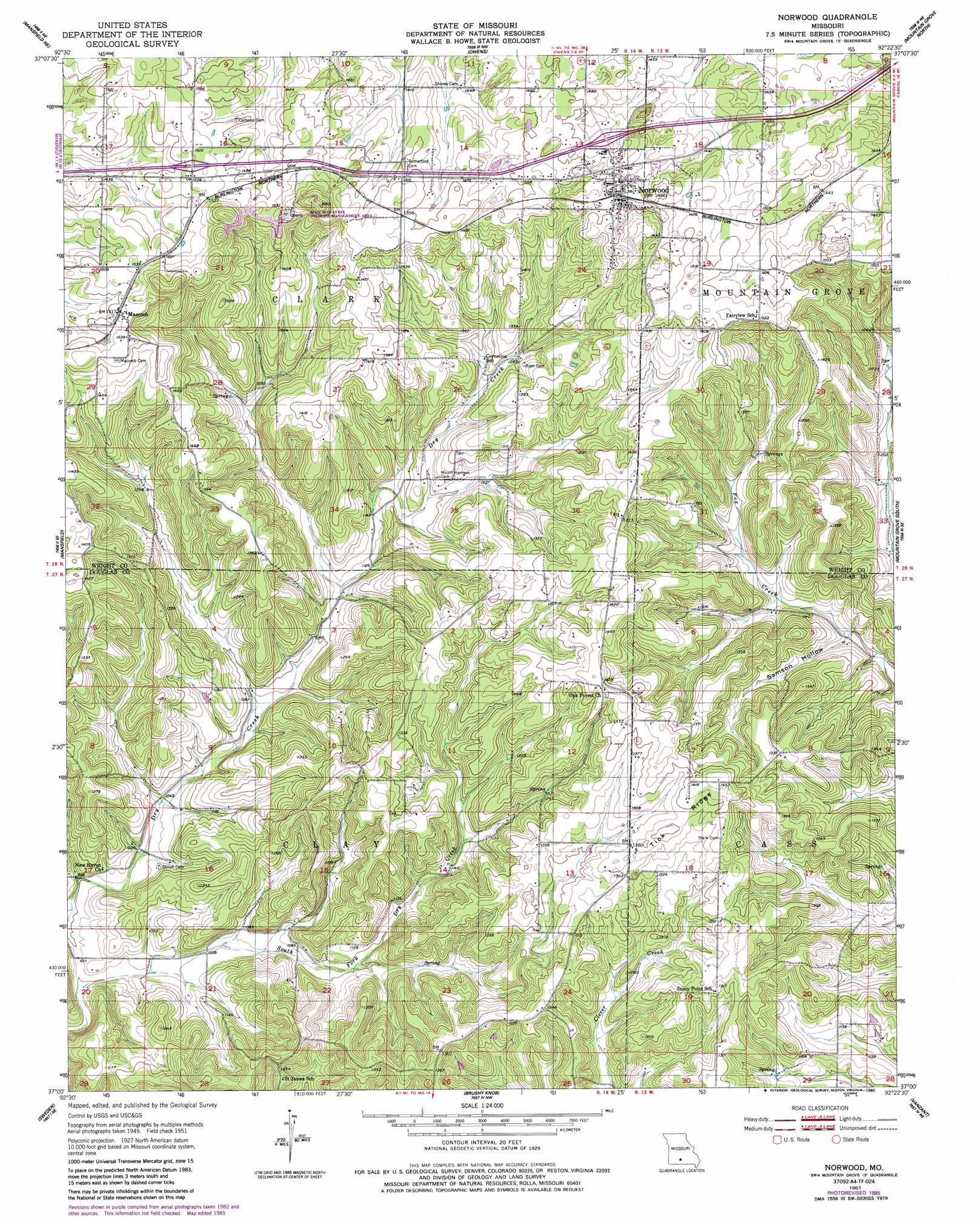
Norwood Topo Map Missouri
To zoom in, hover over the map of Norwood
USGS Topo Quad 37092a4 - 1:24,000 scale
| Topo Map Name: | Norwood |
| USGS Topo Quad ID: | 37092a4 |
| Print Size: | ca. 21 1/4" wide x 27" high |
| Southeast Coordinates: | 37° N latitude / 92.375° W longitude |
| Map Center Coordinates: | 37.0625° N latitude / 92.4375° W longitude |
| U.S. State: | MO |
| Filename: | o37092a4.jpg |
| Download Map JPG Image: | Norwood topo map 1:24,000 scale |
| Map Type: | Topographic |
| Topo Series: | 7.5´ |
| Map Scale: | 1:24,000 |
| Source of Map Images: | United States Geological Survey (USGS) |
| Alternate Map Versions: |
Norwood MO 1951, updated 1952 Download PDF Buy paper map Norwood MO 1951, updated 1985 Download PDF Buy paper map Norwood MO 2011 Download PDF Buy paper map Norwood MO 2015 Download PDF Buy paper map |
1:24,000 Topo Quads surrounding Norwood
Duncan |
Hartville |
Fuson |
Dawson |
Huggins |
Mansfield Nw |
Mansfield Ne |
Owens |
Mountain Grove North |
Cabool Nw |
Cedar Gap |
Mansfield |
Norwood |
Mountain Grove South |
Cabool Sw |
Ava |
Sweden |
Brushyknob |
Vanzant |
Nichols Knob |
Smallett |
Wasola |
Rockbridge |
Gentryville |
Dora |
> Back to 37092a1 at 1:100,000 scale
> Back to 37092a1 at 1:250,000 scale
> Back to U.S. Topo Maps home
Norwood topo map: Gazetteer
Norwood: Dams
McIntosh Lake Dam elevation 369m 1210′Norwood: Populated Places
Filer elevation 418m 1371′Macomb elevation 463m 1519′
Norwood elevation 454m 1489′
Norwood: Post Offices
Filer Post Office (historical) elevation 418m 1371′Norwood: Ridges
Tick Ridge elevation 423m 1387′Norwood: Summits
Mary Gray Hill elevation 502m 1646′Norwood: Valleys
Samson Hollow elevation 339m 1112′Norwood digital topo map on disk
Buy this Norwood topo map showing relief, roads, GPS coordinates and other geographical features, as a high-resolution digital map file on DVD: