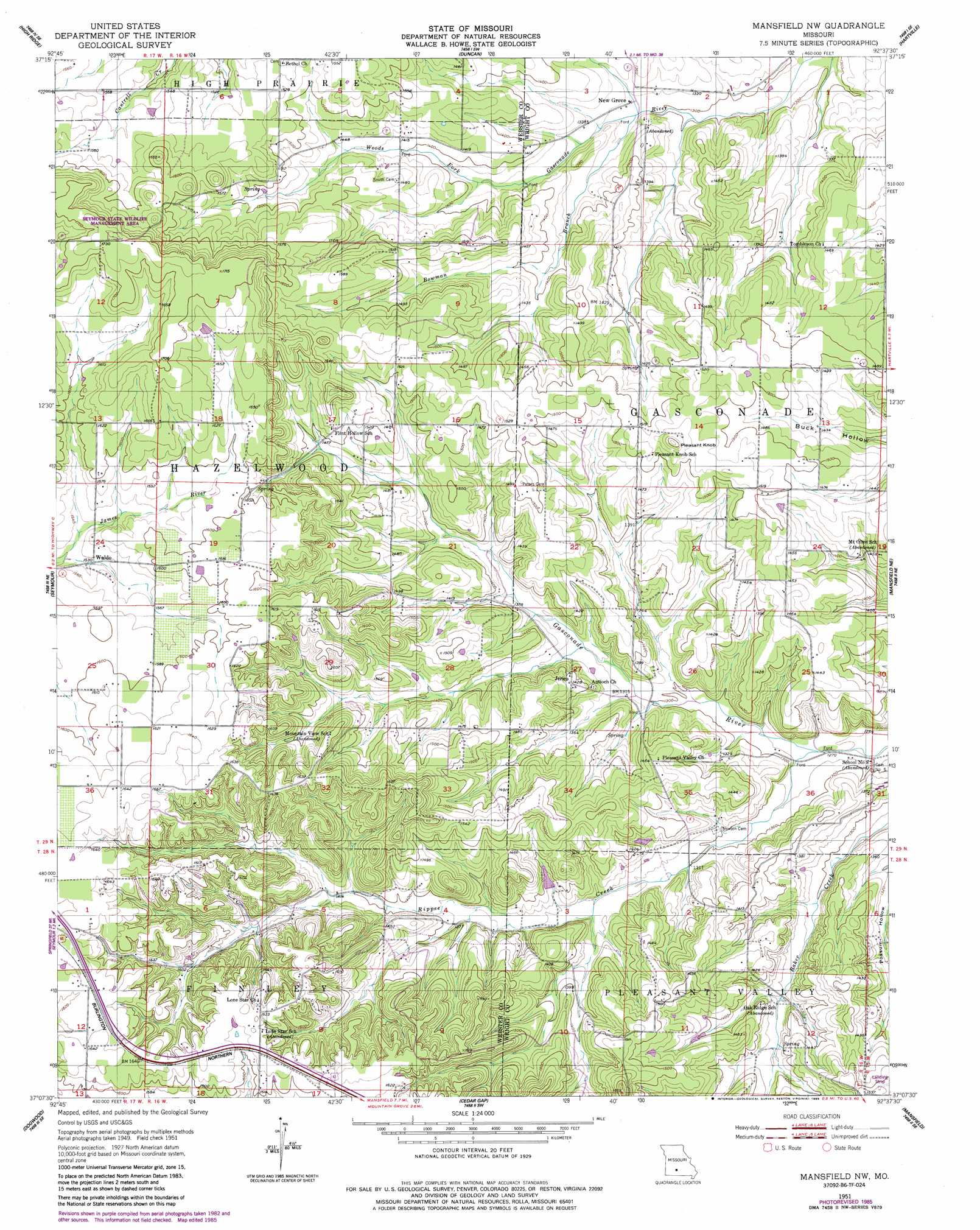
Mansfield Nw Topo Map Missouri
To zoom in, hover over the map of Mansfield Nw
USGS Topo Quad 37092b6 - 1:24,000 scale
| Topo Map Name: | Mansfield Nw |
| USGS Topo Quad ID: | 37092b6 |
| Print Size: | ca. 21 1/4" wide x 27" high |
| Southeast Coordinates: | 37.125° N latitude / 92.625° W longitude |
| Map Center Coordinates: | 37.1875° N latitude / 92.6875° W longitude |
| U.S. State: | MO |
| Filename: | o37092b6.jpg |
| Download Map JPG Image: | Mansfield Nw topo map 1:24,000 scale |
| Map Type: | Topographic |
| Topo Series: | 7.5´ |
| Map Scale: | 1:24,000 |
| Source of Map Images: | United States Geological Survey (USGS) |
| Alternate Map Versions: |
Mansfield NW MO 1951, updated 1953 Download PDF Buy paper map Mansfield NW MO 1985, updated 1985 Download PDF Buy paper map Mansfield NW MO 2011 Download PDF Buy paper map Mansfield NW MO 2015 Download PDF Buy paper map |
1:24,000 Topo Quads surrounding Mansfield Nw
Beach |
Niangua |
Rader |
Grovespring |
Competition |
Marshfield |
High Prarie |
Duncan |
Hartville |
Fuson |
Fordland |
Seymour |
Mansfield Nw |
Mansfield Ne |
Owens |
Bruner |
Dogwood |
Cedar Gap |
Mansfield |
Norwood |
Keltner |
Goodhope |
Ava |
Sweden |
Brushyknob |
> Back to 37092a1 at 1:100,000 scale
> Back to 37092a1 at 1:250,000 scale
> Back to U.S. Topo Maps home
Mansfield Nw topo map: Gazetteer
Mansfield Nw: Airports
Owen Field elevation 478m 1568′Mansfield Nw: Dams
Albert Smouse Dam elevation 484m 1587′Sparlin Lake Section 3 Dam elevation 420m 1377′
Sparlin Lake Section 35 Dam elevation 421m 1381′
Mansfield Nw: Parks
Seymour State Wildlife Management Area elevation 531m 1742′Mansfield Nw: Populated Places
Antrim elevation 430m 1410′Crabbs (historical) elevation 495m 1624′
Jerico elevation 435m 1427′
Midway elevation 465m 1525′
New Grove elevation 400m 1312′
Waldo elevation 467m 1532′
Mansfield Nw: Post Offices
Antrim Post Office elevation 430m 1410′Mansfield Nw: Streams
Bowman Branch elevation 397m 1302′Rippee Creek elevation 386m 1266′
Mansfield Nw: Summits
Pleasant Knob elevation 495m 1624′Mansfield Nw digital topo map on disk
Buy this Mansfield Nw topo map showing relief, roads, GPS coordinates and other geographical features, as a high-resolution digital map file on DVD: