Fordland Topo Map Missouri
To zoom in, hover over the map of Fordland
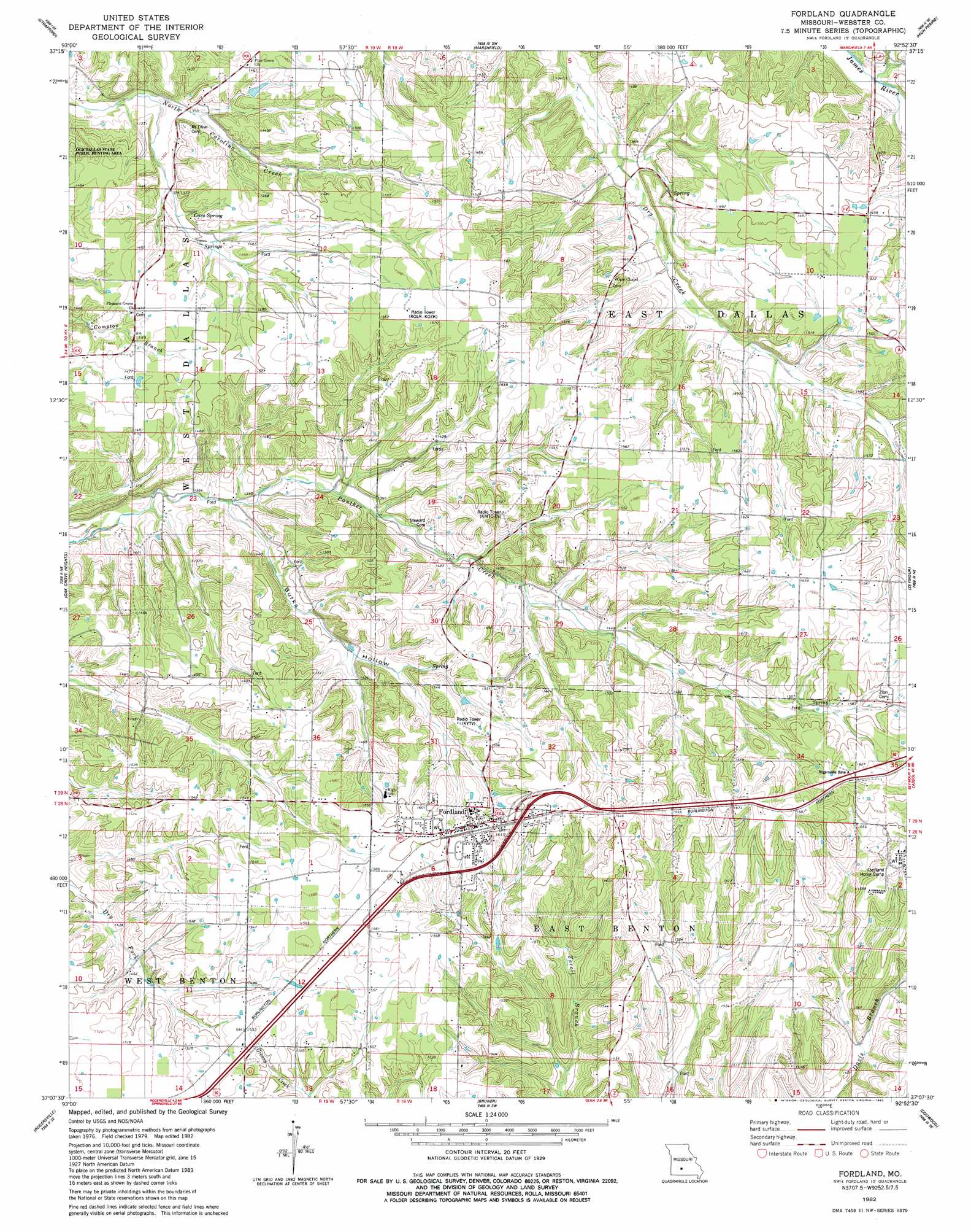
USGS Topo Quad 37092b8 - 1:24,000 scale
| Topo Map Name: | Fordland |
| USGS Topo Quad ID: | 37092b8 |
| Print Size: | ca. 21 1/4" wide x 27" high |
| Southeast Coordinates: | 37.125° N latitude / 92.875° W longitude |
| Map Center Coordinates: | 37.1875° N latitude / 92.9375° W longitude |
| U.S. State: | MO |
| Filename: | o37092b8.jpg |
| Download Map JPG Image: | Fordland topo map 1:24,000 scale |
| Map Type: | Topographic |
| Topo Series: | 7.5´ |
| Map Scale: | 1:24,000 |
| Source of Map Images: | United States Geological Survey (USGS) |
| Alternate Map Versions: |
Fordland MO 1982, updated 1983 Download PDF Buy paper map Fordland MO 2012 Download PDF Buy paper map Fordland MO 2015 Download PDF Buy paper map |
1:24,000 Topo Quads surrounding Fordland
Fair Grove |
Elkland |
Beach |
Niangua |
Rader |
Bassville |
Strafford |
Marshfield |
High Prarie |
Duncan |
Galloway |
Oak Grove Heights |
Fordland |
Seymour |
Mansfield Nw |
Ozark |
Rogersville |
Bruner |
Dogwood |
Cedar Gap |
Selmore |
Chadwick |
Keltner |
Goodhope |
Ava |
> Back to 37092a1 at 1:100,000 scale
> Back to 37092a1 at 1:250,000 scale
> Back to U.S. Topo Maps home
Fordland topo map: Gazetteer
Fordland: Dams
F A Totten Lake Dam elevation 432m 1417′Fordland: Populated Places
Fordland elevation 489m 1604′Fordland: Reservoirs
Totten Lake elevation 432m 1417′Fordland: Springs
Cave Spring elevation 432m 1417′Fordland: Valleys
Burks Hollow elevation 409m 1341′Fordland digital topo map on disk
Buy this Fordland topo map showing relief, roads, GPS coordinates and other geographical features, as a high-resolution digital map file on DVD: