Bucyrus Topo Map Missouri
To zoom in, hover over the map of Bucyrus
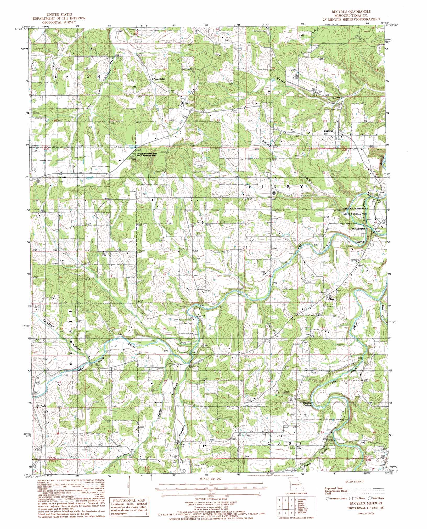
USGS Topo Quad 37092c1 - 1:24,000 scale
| Topo Map Name: | Bucyrus |
| USGS Topo Quad ID: | 37092c1 |
| Print Size: | ca. 21 1/4" wide x 27" high |
| Southeast Coordinates: | 37.25° N latitude / 92° W longitude |
| Map Center Coordinates: | 37.3125° N latitude / 92.0625° W longitude |
| U.S. State: | MO |
| Filename: | o37092c1.jpg |
| Download Map JPG Image: | Bucyrus topo map 1:24,000 scale |
| Map Type: | Topographic |
| Topo Series: | 7.5´ |
| Map Scale: | 1:24,000 |
| Source of Map Images: | United States Geological Survey (USGS) |
| Alternate Map Versions: |
Bucyrus MO 1987, updated 1987 Download PDF Buy paper map Bucyrus MO 2012 Download PDF Buy paper map Bucyrus MO 2015 Download PDF Buy paper map |
1:24,000 Topo Quads surrounding Bucyrus
Winnipeg |
Roby |
Slabtown Spring |
Beulah |
Maples |
Manes |
Roubidoux |
Success |
Prescott |
Licking |
Dawson |
Huggins |
Bucyrus |
Houston |
Raymondville |
Mountain Grove North |
Cabool Nw |
Cabool Ne |
Elk Creek |
Eunice |
Mountain Grove South |
Cabool Sw |
Cabool Se |
Willow Springs North |
Clear Springs |
> Back to 37092a1 at 1:100,000 scale
> Back to 37092a1 at 1:250,000 scale
> Back to U.S. Topo Maps home
Bucyrus topo map: Gazetteer
Bucyrus: Cliffs
White Rock Bluff elevation 311m 1020′Bucyrus: Gaps
The Narrows elevation 307m 1007′Bucyrus: Parks
Piney River Narrows State Natural Area elevation 327m 1072′Bucyrus: Populated Places
Bado elevation 366m 1200′Bucyrus elevation 375m 1230′
Clara elevation 386m 1266′
Dykes elevation 447m 1466′
Lundy elevation 378m 1240′
Plum Valley elevation 403m 1322′
Bucyrus: Post Offices
Lundy Post Office elevation 381m 1250′Bucyrus: Springs
Dripping Springs elevation 328m 1076′Bucyrus: Streams
Hamilton Creek elevation 322m 1056′Hog Creek elevation 311m 1020′
Little Piney River elevation 304m 997′
Opossum Creek elevation 323m 1059′
Rocky Branch elevation 323m 1059′
Rocky Branch elevation 326m 1069′
Bucyrus: Valleys
Hungry Hollow elevation 307m 1007′Spurlock Hollow elevation 334m 1095′
Bucyrus digital topo map on disk
Buy this Bucyrus topo map showing relief, roads, GPS coordinates and other geographical features, as a high-resolution digital map file on DVD: