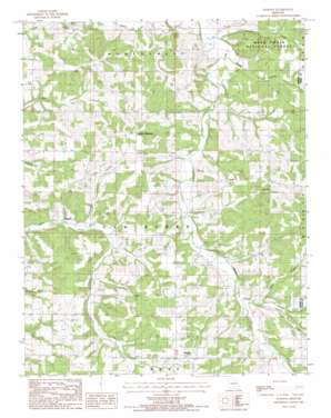
Dawson Topo Map Missouri
To zoom in, hover over the map of Dawson
USGS Topo Quad 37092c3 - 1:24,000 scale
| Topo Map Name: | Dawson |
| USGS Topo Quad ID: | 37092c3 |
| Print Size: | ca. 21 1/4" wide x 27" high |
| Southeast Coordinates: | 37.25° N latitude / 92.25° W longitude |
| Map Center Coordinates: | 37.3125° N latitude / 92.3125° W longitude |
| U.S. State: | MO |
| Filename: | o37092c3.jpg |
| Download Map JPG Image: | Dawson topo map 1:24,000 scale |
| Map Type: | Topographic |
| Topo Series: | 7.5´ |
| Map Scale: | 1:24,000 |
| Source of Map Images: | United States Geological Survey (USGS) |
| Alternate Map Versions: |
Dawson MO 1987, updated 1987 Download PDF Buy paper map Dawson MO 2004, updated 2006 Download PDF Buy paper map Dawson MO 2012 Download PDF Buy paper map Dawson MO 2015 Download PDF Buy paper map |
| FStopo: | US Forest Service topo Dawson is available: Download FStopo PDF Download FStopo TIF |
1:24,000 Topo Quads surrounding Dawson
> Back to 37092a1 at 1:100,000 scale
> Back to 37092a1 at 1:250,000 scale
> Back to U.S. Topo Maps home
Dawson topo map: Gazetteer
Dawson: Airports
Belly Acres Ranch Airport elevation 384m 1259′Dawson: Populated Places
Dawson elevation 436m 1430′Graff elevation 406m 1332′
Green Mountain elevation 434m 1423′
Rail elevation 384m 1259′
Rayborn elevation 345m 1131′
Dawson: Streams
Doolittle Creek elevation 371m 1217′North Fork Beaver Creek elevation 364m 1194′
Pollock Creek elevation 343m 1125′
Sugar Creek elevation 368m 1207′
Tom Branch elevation 354m 1161′
Dawson: Valleys
Dean Hollow elevation 345m 1131′Hattie Hollow elevation 342m 1122′
Prairie Hollow elevation 348m 1141′
Schoolhouse Hollow elevation 348m 1141′
Dawson digital topo map on disk
Buy this Dawson topo map showing relief, roads, GPS coordinates and other geographical features, as a high-resolution digital map file on DVD:


