Competition Topo Map Missouri
To zoom in, hover over the map of Competition
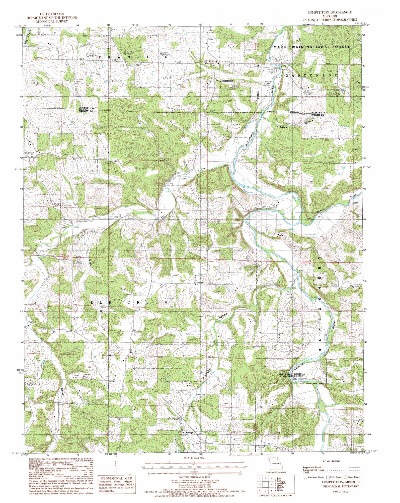
USGS Topo Quad 37092d4 - 1:24,000 scale
| Topo Map Name: | Competition |
| USGS Topo Quad ID: | 37092d4 |
| Print Size: | ca. 21 1/4" wide x 27" high |
| Southeast Coordinates: | 37.375° N latitude / 92.375° W longitude |
| Map Center Coordinates: | 37.4375° N latitude / 92.4375° W longitude |
| U.S. State: | MO |
| Filename: | o37092d4.jpg |
| Download Map JPG Image: | Competition topo map 1:24,000 scale |
| Map Type: | Topographic |
| Topo Series: | 7.5´ |
| Map Scale: | 1:24,000 |
| Source of Map Images: | United States Geological Survey (USGS) |
| Alternate Map Versions: |
Competition MO 1987, updated 1987 Download PDF Buy paper map Competition MO 2004, updated 2006 Download PDF Buy paper map Competition MO 2012 Download PDF Buy paper map Competition MO 2015 Download PDF Buy paper map |
| FStopo: | US Forest Service topo Competition is available: Download FStopo PDF Download FStopo TIF |
1:24,000 Topo Quads surrounding Competition
Lebanon |
Oakland |
Drynob |
Brownfield |
Bloodland |
Brush Creek |
Russ |
Drew |
Winnipeg |
Roby |
Rader |
Grovespring |
Competition |
Manes |
Roubidoux |
Duncan |
Hartville |
Fuson |
Dawson |
Huggins |
Mansfield Nw |
Mansfield Ne |
Owens |
Mountain Grove North |
Cabool Nw |
> Back to 37092a1 at 1:100,000 scale
> Back to 37092a1 at 1:250,000 scale
> Back to U.S. Topo Maps home
Competition topo map: Gazetteer
Competition: Parks
Wilber Allen Memorial State Wildlife Area elevation 317m 1040′Competition: Populated Places
Burney Ford elevation 310m 1017′Competition elevation 347m 1138′
Jerktail elevation 398m 1305′
Saint George elevation 384m 1259′
Competition: Streams
Beaver Creek elevation 309m 1013′Elk Creek elevation 305m 1000′
Scotts Branch elevation 339m 1112′
Sutton Branch elevation 305m 1000′
Webb Creek elevation 324m 1062′
Competition: Valleys
Hillhouse Hollow elevation 314m 1030′Wichita Hollow elevation 312m 1023′
Competition digital topo map on disk
Buy this Competition topo map showing relief, roads, GPS coordinates and other geographical features, as a high-resolution digital map file on DVD: