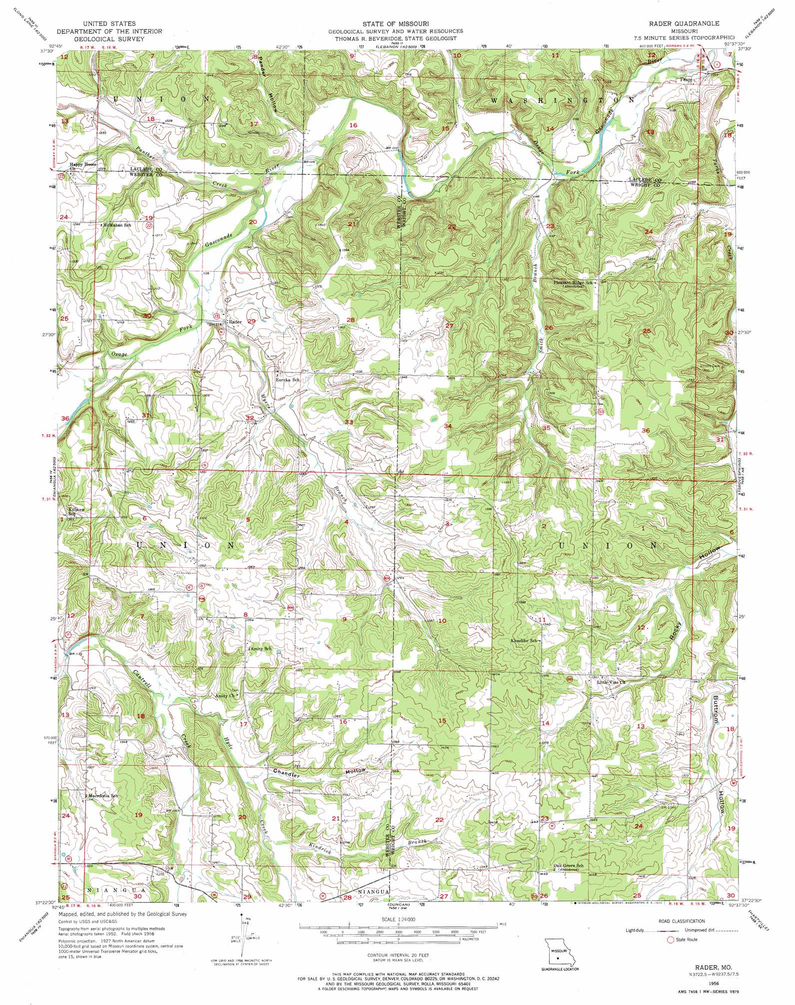
Rader Topo Map Missouri
To zoom in, hover over the map of Rader
USGS Topo Quad 37092d6 - 1:24,000 scale
| Topo Map Name: | Rader |
| USGS Topo Quad ID: | 37092d6 |
| Print Size: | ca. 21 1/4" wide x 27" high |
| Southeast Coordinates: | 37.375° N latitude / 92.625° W longitude |
| Map Center Coordinates: | 37.4375° N latitude / 92.6875° W longitude |
| U.S. State: | MO |
| Filename: | o37092d6.jpg |
| Download Map JPG Image: | Rader topo map 1:24,000 scale |
| Map Type: | Topographic |
| Topo Series: | 7.5´ |
| Map Scale: | 1:24,000 |
| Source of Map Images: | United States Geological Survey (USGS) |
| Alternate Map Versions: |
Rader MO 1956, updated 1957 Download PDF Buy paper map Rader MO 1956, updated 1973 Download PDF Buy paper map Rader MO 2011 Download PDF Buy paper map Rader MO 2015 Download PDF Buy paper map |
1:24,000 Topo Quads surrounding Rader
Windyville |
Bennett Springs |
Lebanon |
Oakland |
Drynob |
Long Lake |
Phillipsburg |
Brush Creek |
Russ |
Drew |
Beach |
Niangua |
Rader |
Grovespring |
Competition |
Marshfield |
High Prarie |
Duncan |
Hartville |
Fuson |
Fordland |
Seymour |
Mansfield Nw |
Mansfield Ne |
Owens |
> Back to 37092a1 at 1:100,000 scale
> Back to 37092a1 at 1:250,000 scale
> Back to U.S. Topo Maps home
Rader topo map: Gazetteer
Rader: Dams
A J Shrubar Dam elevation 416m 1364′D and R Lake Lower Dam elevation 403m 1322′
D and R Lake Upper Dam elevation 420m 1377′
Lehar Lake Dam elevation 395m 1295′
Rader: Populated Places
Pease elevation 343m 1125′Rader elevation 349m 1145′
Susanna elevation 379m 1243′
Rader: Reservoirs
A J Shrubar Lake elevation 416m 1364′Lawson Lake elevation 420m 1377′
Rader: Streams
Hyde Creek elevation 360m 1181′Kindrick Branch elevation 372m 1220′
Myers Branch elevation 344m 1128′
Panther Creek elevation 340m 1115′
Smith Branch elevation 329m 1079′
Rader: Valleys
Chandler Hollow elevation 370m 1213′Pender Hollow elevation 342m 1122′
Phillips Hollow elevation 331m 1085′
Rader digital topo map on disk
Buy this Rader topo map showing relief, roads, GPS coordinates and other geographical features, as a high-resolution digital map file on DVD: