Beach Topo Map Missouri
To zoom in, hover over the map of Beach
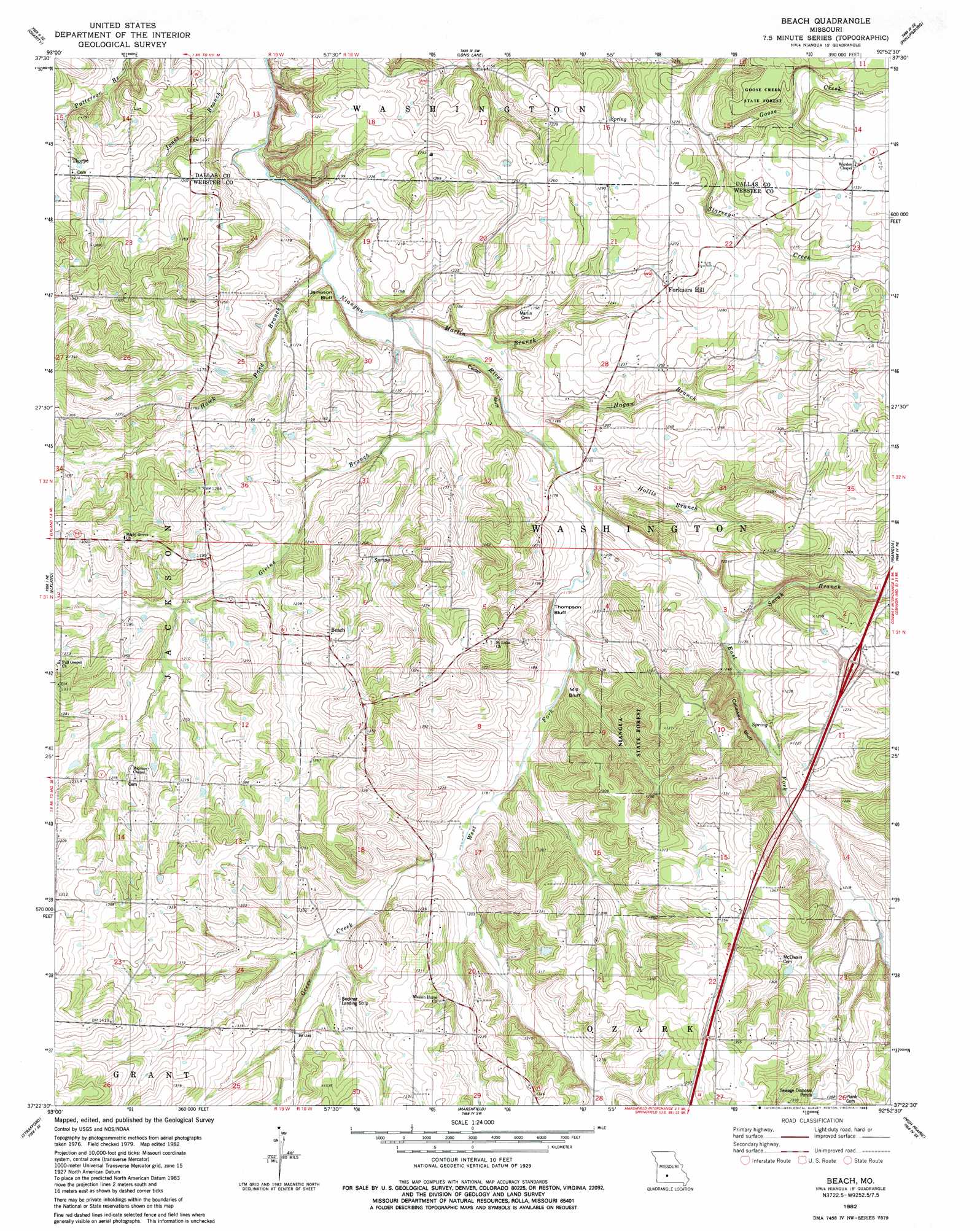
USGS Topo Quad 37092d8 - 1:24,000 scale
| Topo Map Name: | Beach |
| USGS Topo Quad ID: | 37092d8 |
| Print Size: | ca. 21 1/4" wide x 27" high |
| Southeast Coordinates: | 37.375° N latitude / 92.875° W longitude |
| Map Center Coordinates: | 37.4375° N latitude / 92.9375° W longitude |
| U.S. State: | MO |
| Filename: | o37092d8.jpg |
| Download Map JPG Image: | Beach topo map 1:24,000 scale |
| Map Type: | Topographic |
| Topo Series: | 7.5´ |
| Map Scale: | 1:24,000 |
| Source of Map Images: | United States Geological Survey (USGS) |
| Alternate Map Versions: |
Beach MO 1982, updated 1983 Download PDF Buy paper map Beach MO 2011 Download PDF Buy paper map Beach MO 2015 Download PDF Buy paper map |
1:24,000 Topo Quads surrounding Beach
Buffalo Nw |
Buffalo |
Windyville |
Bennett Springs |
Lebanon |
Half Way |
Charity |
Long Lake |
Phillipsburg |
Brush Creek |
Fair Grove |
Elkland |
Beach |
Niangua |
Rader |
Bassville |
Strafford |
Marshfield |
High Prarie |
Duncan |
Galloway |
Oak Grove Heights |
Fordland |
Seymour |
Mansfield Nw |
> Back to 37092a1 at 1:100,000 scale
> Back to 37092a1 at 1:250,000 scale
> Back to U.S. Topo Maps home
Beach topo map: Gazetteer
Beach: Airports
Beckner Field elevation 391m 1282′Beach: Cliffs
Callaway Bluff elevation 409m 1341′Jameson Bluff elevation 354m 1161′
Mill Bluff elevation 371m 1217′
Thompson Bluff elevation 371m 1217′
Beach: Populated Places
Beach elevation 383m 1256′Dermott elevation 388m 1272′
Forkners Hill elevation 381m 1250′
Thorpe elevation 372m 1220′
Beach: Streams
East Fork Niangua River elevation 344m 1128′Givins Branch elevation 339m 1112′
Goose Creek elevation 375m 1230′
Greer Creek elevation 357m 1171′
Hagan Branch elevation 341m 1118′
Hawk Pond Branch elevation 336m 1102′
Hollis Branch elevation 343m 1125′
Marlin Branch elevation 340m 1115′
Sarah Branch elevation 353m 1158′
West Fork Niangua River elevation 345m 1131′
Beach digital topo map on disk
Buy this Beach topo map showing relief, roads, GPS coordinates and other geographical features, as a high-resolution digital map file on DVD: