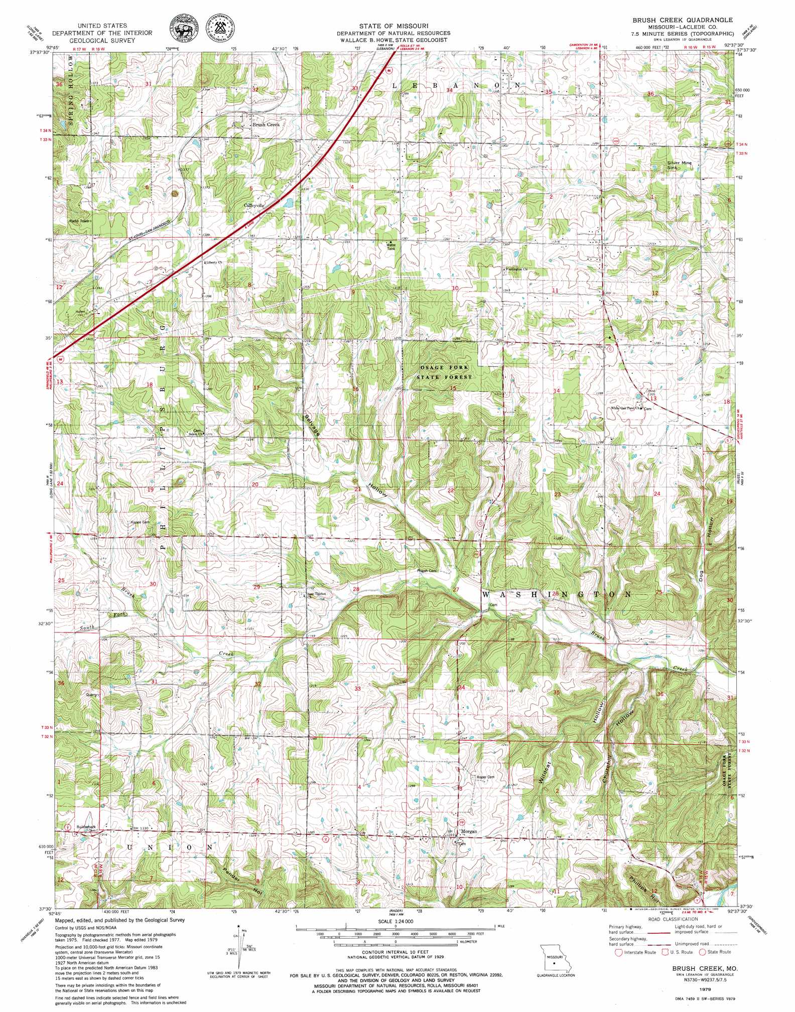
Brush Creek Topo Map Missouri
To zoom in, hover over the map of Brush Creek
USGS Topo Quad 37092e6 - 1:24,000 scale
| Topo Map Name: | Brush Creek |
| USGS Topo Quad ID: | 37092e6 |
| Print Size: | ca. 21 1/4" wide x 27" high |
| Southeast Coordinates: | 37.5° N latitude / 92.625° W longitude |
| Map Center Coordinates: | 37.5625° N latitude / 92.6875° W longitude |
| U.S. State: | MO |
| Filename: | o37092e6.jpg |
| Download Map JPG Image: | Brush Creek topo map 1:24,000 scale |
| Map Type: | Topographic |
| Topo Series: | 7.5´ |
| Map Scale: | 1:24,000 |
| Source of Map Images: | United States Geological Survey (USGS) |
| Alternate Map Versions: |
Lebanon SW MO 1975, updated 1976 Download PDF Buy paper map Brush Creek MO 1979, updated 1980 Download PDF Buy paper map Brush Creek MO 2011 Download PDF Buy paper map Brush Creek MO 2015 Download PDF Buy paper map |
1:24,000 Topo Quads surrounding Brush Creek
Leadmine |
Eldridge West |
Eldridge East |
Stoutland |
Richland |
Windyville |
Bennett Springs |
Lebanon |
Oakland |
Drynob |
Long Lake |
Phillipsburg |
Brush Creek |
Russ |
Drew |
Beach |
Niangua |
Rader |
Grovespring |
Competition |
Marshfield |
High Prarie |
Duncan |
Hartville |
Fuson |
> Back to 37092e1 at 1:100,000 scale
> Back to 37092a1 at 1:250,000 scale
> Back to U.S. Topo Maps home
Brush Creek topo map: Gazetteer
Brush Creek: Basins
Silver Mine Sink elevation 383m 1256′Brush Creek: Dams
Ecklund Lake Dam elevation 404m 1325′Brush Creek: Populated Places
Brush Creek elevation 395m 1295′Caffeyville elevation 415m 1361′
Morgan elevation 382m 1253′
Brush Creek: Streams
South Fork Brush Creek elevation 362m 1187′Brush Creek: Valleys
Churchill Hollow elevation 326m 1069′Dog Hollow elevation 330m 1082′
Selvage Hollow elevation 339m 1112′
Wildcat Hollow elevation 325m 1066′
Brush Creek digital topo map on disk
Buy this Brush Creek topo map showing relief, roads, GPS coordinates and other geographical features, as a high-resolution digital map file on DVD: