Long Lake Topo Map Missouri
To zoom in, hover over the map of Long Lake
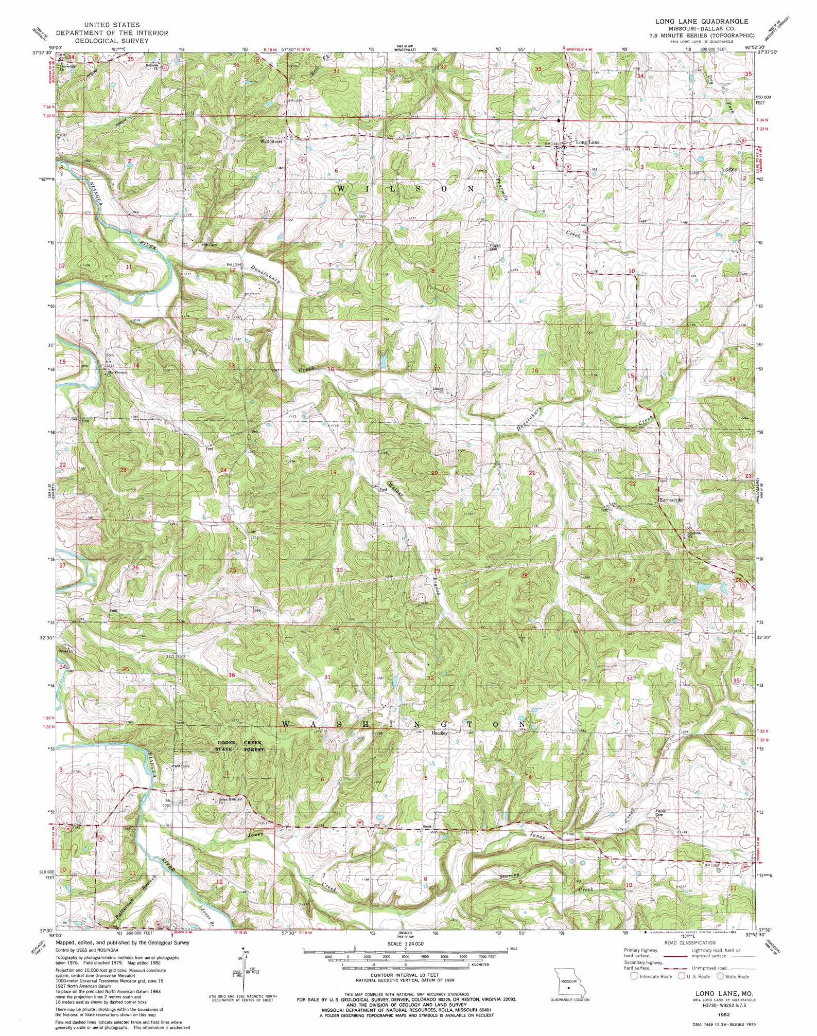
USGS Topo Quad 37092e8 - 1:24,000 scale
| Topo Map Name: | Long Lake |
| USGS Topo Quad ID: | 37092e8 |
| Print Size: | ca. 21 1/4" wide x 27" high |
| Southeast Coordinates: | 37.5° N latitude / 92.875° W longitude |
| Map Center Coordinates: | 37.5625° N latitude / 92.9375° W longitude |
| U.S. State: | MO |
| Filename: | o37092e8.jpg |
| Download Map JPG Image: | Long Lake topo map 1:24,000 scale |
| Map Type: | Topographic |
| Topo Series: | 7.5´ |
| Map Scale: | 1:24,000 |
| Source of Map Images: | United States Geological Survey (USGS) |
| Alternate Map Versions: |
Long Lane MO 1982, updated 1983 Download PDF Buy paper map Long Lane MO 2011 Download PDF Buy paper map Long Lane MO 2015 Download PDF Buy paper map |
1:24,000 Topo Quads surrounding Long Lake
Urbana |
Tunas |
Leadmine |
Eldridge West |
Eldridge East |
Buffalo Nw |
Buffalo |
Windyville |
Bennett Springs |
Lebanon |
Half Way |
Charity |
Long Lake |
Phillipsburg |
Brush Creek |
Fair Grove |
Elkland |
Beach |
Niangua |
Rader |
Bassville |
Strafford |
Marshfield |
High Prarie |
Duncan |
> Back to 37092e1 at 1:100,000 scale
> Back to 37092a1 at 1:250,000 scale
> Back to U.S. Topo Maps home
Long Lake topo map: Gazetteer
Long Lake: Dams
Thurman Lake Dam elevation 376m 1233′Long Lake: Populated Places
Earnestville elevation 387m 1269′Gaunt Ford (historical) elevation 305m 1000′
Handley elevation 398m 1305′
Limekiln Ford (historical) elevation 339m 1112′
Long Lane elevation 346m 1135′
Shady Grove elevation 381m 1250′
Wall Street elevation 364m 1194′
Long Lake: Streams
Dousinbury Creek elevation 308m 1010′Jones Branch elevation 328m 1076′
Jones Creek elevation 326m 1069′
Patterson Branch elevation 326m 1069′
Starvey Creek elevation 343m 1125′
Walker Branch elevation 318m 1043′
Long Lake: Valleys
Phillips Hollow elevation 349m 1145′Long Lake digital topo map on disk
Buy this Long Lake topo map showing relief, roads, GPS coordinates and other geographical features, as a high-resolution digital map file on DVD: