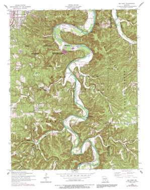
Big Piney Topo Map Missouri
To zoom in, hover over the map of Big Piney
USGS Topo Quad 37092f1 - 1:24,000 scale
| Topo Map Name: | Big Piney |
| USGS Topo Quad ID: | 37092f1 |
| Print Size: | ca. 21 1/4" wide x 27" high |
| Southeast Coordinates: | 37.625° N latitude / 92° W longitude |
| Map Center Coordinates: | 37.6875° N latitude / 92.0625° W longitude |
| U.S. State: | MO |
| Filename: | o37092f1.jpg |
| Download Map JPG Image: | Big Piney topo map 1:24,000 scale |
| Map Type: | Topographic |
| Topo Series: | 7.5´ |
| Map Scale: | 1:24,000 |
| Source of Map Images: | United States Geological Survey (USGS) |
| Alternate Map Versions: |
Big Piney MO 1954, updated 1959 Download PDF Buy paper map Big Piney MO 1954, updated 1971 Download PDF Buy paper map Big Piney MO 1954, updated 1977 Download PDF Buy paper map Big Piney MO 1954, updated 1981 Download PDF Buy paper map Big Piney MO 1954, updated 1990 Download PDF Buy paper map Big Piney MO 1954, updated 1991 Download PDF Buy paper map Big Piney MO 1976, updated 1980 Download PDF Buy paper map Big Piney MO 2004, updated 2006 Download PDF Buy paper map Big Piney MO 2012 Download PDF Buy paper map Big Piney MO 2015 Download PDF Buy paper map |
| FStopo: | US Forest Service topo Big Piney is available: Download FStopo PDF Download FStopo TIF |
1:24,000 Topo Quads surrounding Big Piney
> Back to 37092e1 at 1:100,000 scale
> Back to 37092a1 at 1:250,000 scale
> Back to U.S. Topo Maps home
Big Piney topo map: Gazetteer
Big Piney: Bars
Wildcat Shoal elevation 239m 784′Big Piney: Dams
Bloodland Quad Number 3 Dam elevation 316m 1036′Big Piney: Forests
Rolla - Houston Ranger Districts elevation 327m 1072′Big Piney: Lakes
Dairy Pond elevation 319m 1046′Big Piney: Populated Places
Big Piney elevation 336m 1102′Duke elevation 341m 1118′
Ross Bridge elevation 251m 823′
Big Piney: Ridges
Democrat Ridge elevation 349m 1145′Big Piney: Springs
Miller Spring elevation 243m 797′Stone Mill Spring elevation 238m 780′
Big Piney: Streams
Bald Ridge Creek elevation 250m 820′Little Bald Ridge Creek elevation 262m 859′
Big Piney: Trails
Big Piney National Scenic Trail elevation 299m 980′Big Piney: Valleys
Cap Hollow elevation 287m 941′Crossing Hollow elevation 258m 846′
Falls Hollow elevation 266m 872′
McCourtney Hollow elevation 246m 807′
Spring Hollow elevation 239m 784′
Watts Hollow elevation 248m 813′
Wildcat Hollow elevation 290m 951′
Big Piney digital topo map on disk
Buy this Big Piney topo map showing relief, roads, GPS coordinates and other geographical features, as a high-resolution digital map file on DVD:


