Oakland Topo Map Missouri
To zoom in, hover over the map of Oakland
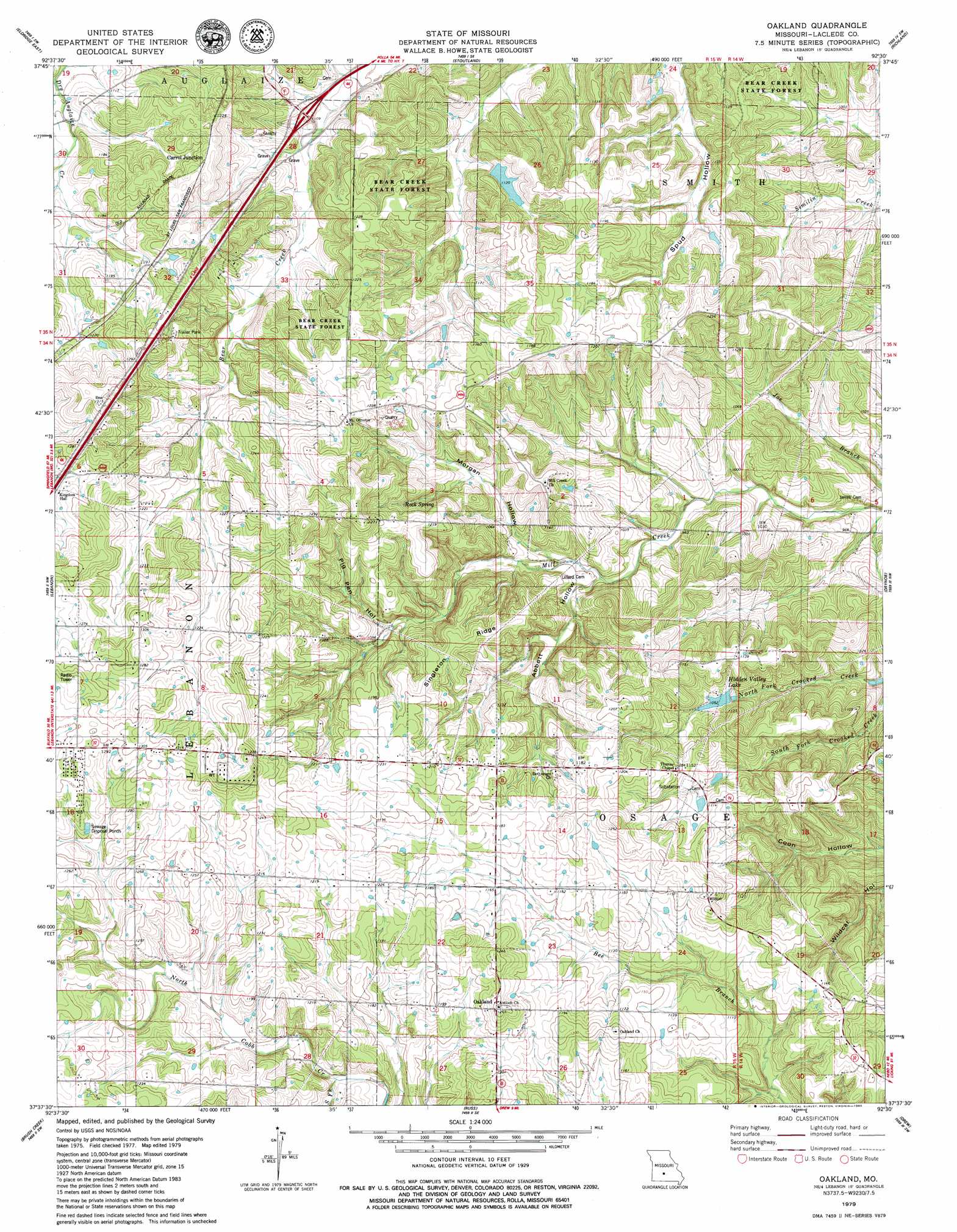
USGS Topo Quad 37092f5 - 1:24,000 scale
| Topo Map Name: | Oakland |
| USGS Topo Quad ID: | 37092f5 |
| Print Size: | ca. 21 1/4" wide x 27" high |
| Southeast Coordinates: | 37.625° N latitude / 92.5° W longitude |
| Map Center Coordinates: | 37.6875° N latitude / 92.5625° W longitude |
| U.S. State: | MO |
| Filename: | o37092f5.jpg |
| Download Map JPG Image: | Oakland topo map 1:24,000 scale |
| Map Type: | Topographic |
| Topo Series: | 7.5´ |
| Map Scale: | 1:24,000 |
| Source of Map Images: | United States Geological Survey (USGS) |
| Alternate Map Versions: |
Lebanon NE MO 1975, updated 1976 Download PDF Buy paper map Oakland MO 1979, updated 1980 Download PDF Buy paper map Oakland MO 2011 Download PDF Buy paper map Oakland MO 2015 Download PDF Buy paper map |
1:24,000 Topo Quads surrounding Oakland
Hahatonka |
Decaturville |
Montreal |
Conns Creek |
Crocker |
Eldridge West |
Eldridge East |
Stoutland |
Richland |
Ozark Springs |
Bennett Springs |
Lebanon |
Oakland |
Drynob |
Brownfield |
Phillipsburg |
Brush Creek |
Russ |
Drew |
Winnipeg |
Niangua |
Rader |
Grovespring |
Competition |
Manes |
> Back to 37092e1 at 1:100,000 scale
> Back to 37092a1 at 1:250,000 scale
> Back to U.S. Topo Maps home
Oakland topo map: Gazetteer
Oakland: Dams
Hidden Valley Lake Dam elevation 321m 1053′Wilderness Lake Dam elevation 342m 1122′
Oakland: Forests
Bear Creek State Forest elevation 369m 1210′Oakland: Populated Places
Carrol Junction elevation 377m 1236′Oakland elevation 380m 1246′
Oakland: Post Offices
Ridgewood Post Office elevation 376m 1233′Oakland: Reservoirs
Hidden Valley Lake elevation 321m 1053′Wilderness Lake elevation 342m 1122′
Oakland: Ridges
Singleton Ridge elevation 361m 1184′Oakland: Springs
Rock Spring elevation 350m 1148′Oakland: Streams
South Fork North Cobb Creek elevation 338m 1108′Oakland: Valleys
Abbott Hollow elevation 302m 990′Morgan Hollow elevation 303m 994′
Pig Pen Hollow elevation 331m 1085′
Oakland digital topo map on disk
Buy this Oakland topo map showing relief, roads, GPS coordinates and other geographical features, as a high-resolution digital map file on DVD: