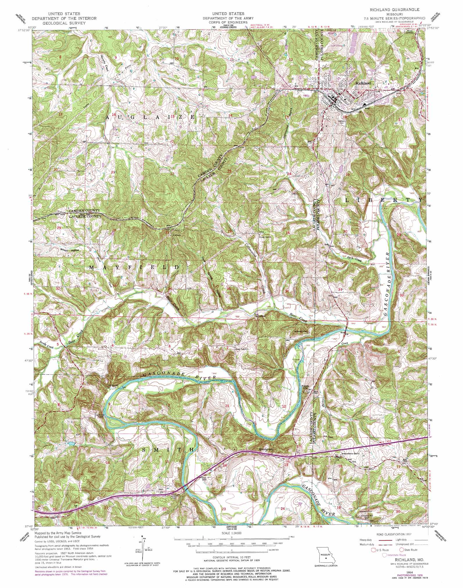
Richland Topo Map Missouri
To zoom in, hover over the map of Richland
USGS Topo Quad 37092g4 - 1:24,000 scale
| Topo Map Name: | Richland |
| USGS Topo Quad ID: | 37092g4 |
| Print Size: | ca. 21 1/4" wide x 27" high |
| Southeast Coordinates: | 37.75° N latitude / 92.375° W longitude |
| Map Center Coordinates: | 37.8125° N latitude / 92.4375° W longitude |
| U.S. State: | MO |
| Filename: | o37092g4.jpg |
| Download Map JPG Image: | Richland topo map 1:24,000 scale |
| Map Type: | Topographic |
| Topo Series: | 7.5´ |
| Map Scale: | 1:24,000 |
| Source of Map Images: | United States Geological Survey (USGS) |
| Alternate Map Versions: |
Richland MO 1954, updated 1959 Download PDF Buy paper map Richland MO 1954, updated 1977 Download PDF Buy paper map Richland MO 2012 Download PDF Buy paper map Richland MO 2015 Download PDF Buy paper map |
| FStopo: | US Forest Service topo Richland is available: Download FStopo PDF Download FStopo TIF |
1:24,000 Topo Quads surrounding Richland
Camdenton |
Toronto |
Brumley |
Iberia |
Brays |
Decaturville |
Montreal |
Conns Creek |
Crocker |
Hancock |
Eldridge East |
Stoutland |
Richland |
Ozark Springs |
Waynesville |
Lebanon |
Oakland |
Drynob |
Brownfield |
Bloodland |
Brush Creek |
Russ |
Drew |
Winnipeg |
Roby |
> Back to 37092e1 at 1:100,000 scale
> Back to 37092a1 at 1:250,000 scale
> Back to U.S. Topo Maps home
Richland topo map: Gazetteer
Richland: Dams
Armistead Dam elevation 302m 990′Gillming Lake Dam elevation 279m 915′
Moore Lake Dam elevation 310m 1017′
Rainey Lake Dam elevation 302m 990′
Vancak Lake Dam elevation 286m 938′
Richland: Parks
Eden Roadside Park elevation 295m 967′Richland: Populated Places
Garnsey elevation 336m 1102′Gascozark elevation 324m 1062′
Hazelgreen elevation 295m 967′
Hillhouse Addition elevation 338m 1108′
Richland elevation 346m 1135′
Richland: Post Offices
Colenso Post Office elevation 294m 964′Richland: Reservoirs
Lake Armistead elevation 302m 990′Richland: Springs
Cliff Spring elevation 260m 853′Richland: Streams
Barlow Creek elevation 251m 823′Bear Creek elevation 251m 823′
Cottonwood Branch elevation 280m 918′
Cottonwood Creek elevation 257m 843′
Davis Creek elevation 275m 902′
Duck Creek elevation 249m 816′
Osage Fork Gasconade River elevation 258m 846′
Sandy Creek elevation 280m 918′
Richland: Valleys
Cave Spring Hollow elevation 269m 882′Wilson Hollow elevation 289m 948′
Richland digital topo map on disk
Buy this Richland topo map showing relief, roads, GPS coordinates and other geographical features, as a high-resolution digital map file on DVD: