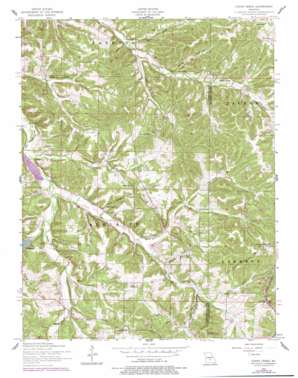
Conns Creek Topo Map Missouri
To zoom in, hover over the map of Conns Creek
USGS Topo Quad 37092h4 - 1:24,000 scale
| Topo Map Name: | Conns Creek |
| USGS Topo Quad ID: | 37092h4 |
| Print Size: | ca. 21 1/4" wide x 27" high |
| Southeast Coordinates: | 37.875° N latitude / 92.375° W longitude |
| Map Center Coordinates: | 37.9375° N latitude / 92.4375° W longitude |
| U.S. State: | MO |
| Filename: | o37092h4.jpg |
| Download Map JPG Image: | Conns Creek topo map 1:24,000 scale |
| Map Type: | Topographic |
| Topo Series: | 7.5´ |
| Map Scale: | 1:24,000 |
| Source of Map Images: | United States Geological Survey (USGS) |
| Alternate Map Versions: |
Conns Creek MO 1954, updated 1959 Download PDF Buy paper map Conns Creek MO 1954, updated 1977 Download PDF Buy paper map Conns Creek MO 2011 Download PDF Buy paper map Conns Creek MO 2015 Download PDF Buy paper map |
1:24,000 Topo Quads surrounding Conns Creek
> Back to 37092e1 at 1:100,000 scale
> Back to 37092a1 at 1:250,000 scale
> Back to U.S. Topo Maps home
Conns Creek topo map: Gazetteer
Conns Creek: Airports
Richland Municipal Airport elevation 337m 1105′Conns Creek: Dams
Atkisson Lake Dam elevation 275m 902′Conns Creek: Populated Places
Glaize (historical) elevation 303m 994′Saint John elevation 327m 1072′
Conns Creek: Streams
Conns Creek elevation 234m 767′Deberry Creek elevation 249m 816′
Murphy Creek elevation 234m 767′
Sellars Creek elevation 235m 770′
Stoops Branch elevation 270m 885′
Conns Creek: Valleys
Brumley Hollow elevation 254m 833′Julia Hollow elevation 241m 790′
Lucas Hollow elevation 238m 780′
Russell Hollow elevation 243m 797′
Seven Springs Hollow elevation 247m 810′
Sock Hollow elevation 244m 800′
Conns Creek digital topo map on disk
Buy this Conns Creek topo map showing relief, roads, GPS coordinates and other geographical features, as a high-resolution digital map file on DVD:


