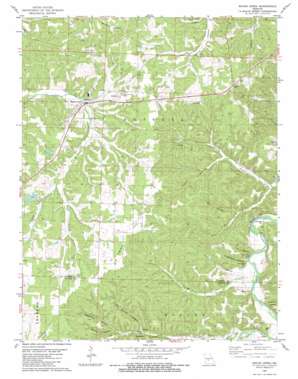
Macks Creek Topo Map Missouri
To zoom in, hover over the map of Macks Creek
USGS Topo Quad 37092h8 - 1:24,000 scale
| Topo Map Name: | Macks Creek |
| USGS Topo Quad ID: | 37092h8 |
| Print Size: | ca. 21 1/4" wide x 27" high |
| Southeast Coordinates: | 37.875° N latitude / 92.875° W longitude |
| Map Center Coordinates: | 37.9375° N latitude / 92.9375° W longitude |
| U.S. State: | MO |
| Filename: | o37092h8.jpg |
| Download Map JPG Image: | Macks Creek topo map 1:24,000 scale |
| Map Type: | Topographic |
| Topo Series: | 7.5´ |
| Map Scale: | 1:24,000 |
| Source of Map Images: | United States Geological Survey (USGS) |
| Alternate Map Versions: |
Macks Creek MO 1982, updated 1983 Download PDF Buy paper map Macks Creek MO 2011 Download PDF Buy paper map Macks Creek MO 2015 Download PDF Buy paper map |
1:24,000 Topo Quads surrounding Macks Creek
> Back to 37092e1 at 1:100,000 scale
> Back to 37092a1 at 1:250,000 scale
> Back to U.S. Topo Maps home
Macks Creek topo map: Gazetteer
Macks Creek: Cliffs
Chapel Bluff elevation 223m 731′Pikes Peak Bluff elevation 243m 797′
Sugarcamp Bluff elevation 248m 813′
Macks Creek: Dams
Carnahan Lake Dam elevation 299m 980′Turner Lake Dam elevation 309m 1013′
Macks Creek: Populated Places
Celt elevation 230m 754′Macks Creek elevation 268m 879′
Miller Ford (historical) elevation 225m 738′
Only elevation 336m 1102′
Macks Creek: Ranges
Niangua Hills elevation 331m 1085′Macks Creek: Streams
A B Creek elevation 219m 718′Jacks Creek elevation 207m 679′
Mill Creek elevation 223m 731′
Macks Creek: Valleys
Adams Hollow elevation 262m 859′Andrew Hollow elevation 224m 734′
Big Spring Hollow elevation 247m 810′
Black Hollow elevation 288m 944′
Cave Hollow elevation 226m 741′
Cob Hollow elevation 219m 718′
Fishhook Hollow elevation 226m 741′
Heggerman Hollow elevation 257m 843′
Mire Hollow elevation 228m 748′
Murray Hollow elevation 286m 938′
Plum Tree Hollow elevation 266m 872′
Sugarcamp Hollow elevation 220m 721′
Macks Creek: Wells
Flowing Well elevation 250m 820′Macks Creek digital topo map on disk
Buy this Macks Creek topo map showing relief, roads, GPS coordinates and other geographical features, as a high-resolution digital map file on DVD:


