Rogersville Topo Map Missouri
To zoom in, hover over the map of Rogersville
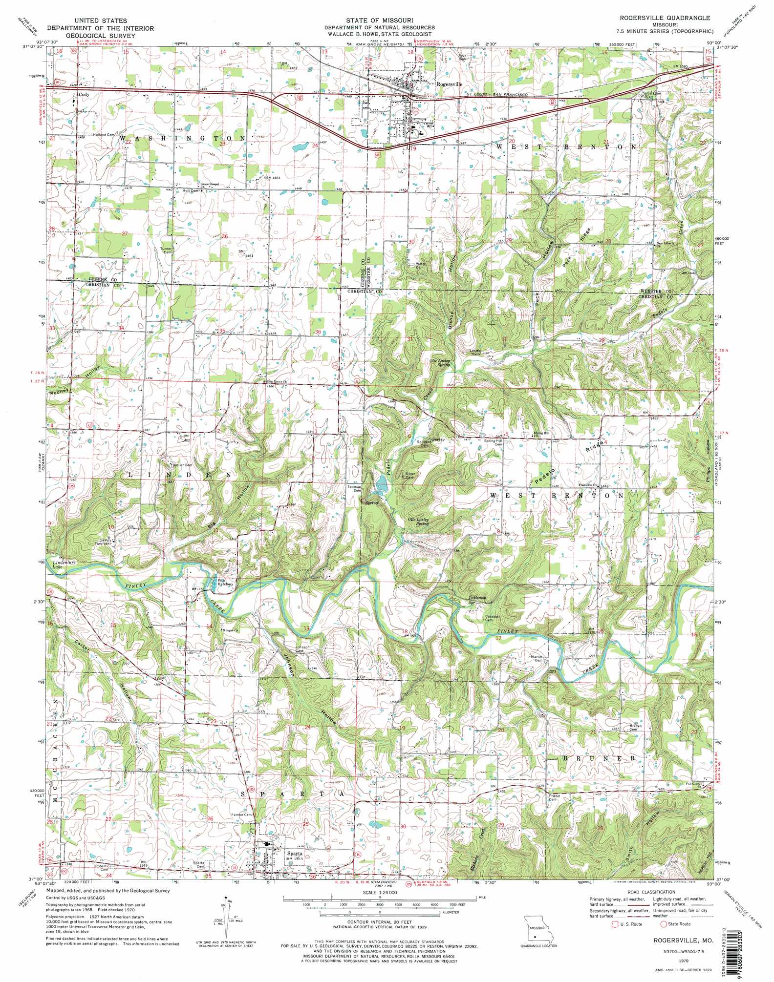
USGS Topo Quad 37093a1 - 1:24,000 scale
| Topo Map Name: | Rogersville |
| USGS Topo Quad ID: | 37093a1 |
| Print Size: | ca. 21 1/4" wide x 27" high |
| Southeast Coordinates: | 37° N latitude / 93° W longitude |
| Map Center Coordinates: | 37.0625° N latitude / 93.0625° W longitude |
| U.S. State: | MO |
| Filename: | o37093a1.jpg |
| Download Map JPG Image: | Rogersville topo map 1:24,000 scale |
| Map Type: | Topographic |
| Topo Series: | 7.5´ |
| Map Scale: | 1:24,000 |
| Source of Map Images: | United States Geological Survey (USGS) |
| Alternate Map Versions: |
Rogersville MO 1970, updated 1971 Download PDF Buy paper map Rogersville MO 1970, updated 1978 Download PDF Buy paper map Rogersville MO 1970, updated 1978 Download PDF Buy paper map Rogersville MO 1979, updated 1981 Download PDF Buy paper map Rogersville MO 2011 Download PDF Buy paper map Rogersville MO 2015 Download PDF Buy paper map |
1:24,000 Topo Quads surrounding Rogersville
Ebenezer |
Bassville |
Strafford |
Marshfield |
High Prarie |
Springfield |
Galloway |
Oak Grove Heights |
Fordland |
Seymour |
Nixa |
Ozark |
Rogersville |
Bruner |
Dogwood |
Highlandville |
Selmore |
Chadwick |
Keltner |
Goodhope |
Spokane |
Day |
Garrison |
Bradleyville |
Brownbranch |
> Back to 37093a1 at 1:100,000 scale
> Back to 37092a1 at 1:250,000 scale
> Back to U.S. Topo Maps home
Rogersville topo map: Gazetteer
Rogersville: Airports
Hindman Airport elevation 405m 1328′Rogersville: Populated Places
Cody elevation 436m 1430′Pembina elevation 422m 1384′
Rogersville elevation 445m 1459′
Sparta elevation 428m 1404′
Velsor elevation 407m 1335′
Rogersville: Post Offices
Pembina Post Office (historical) elevation 422m 1384′Rogersville: Ridges
Peck Ridge elevation 442m 1450′Pedelo Ridge elevation 441m 1446′
Rogersville: Springs
Olie Lasley Spring elevation 381m 1250′Otto Lasley Spring elevation 390m 1279′
Patterson Spring elevation 380m 1246′
Rogersville: Streams
Pedelo Creek elevation 360m 1181′Rogersville: Valleys
Big Hollow elevation 354m 1161′Bishop Hollow elevation 384m 1259′
Johnson Hollow elevation 360m 1181′
Peck Hollow elevation 388m 1272′
Rogersville digital topo map on disk
Buy this Rogersville topo map showing relief, roads, GPS coordinates and other geographical features, as a high-resolution digital map file on DVD: