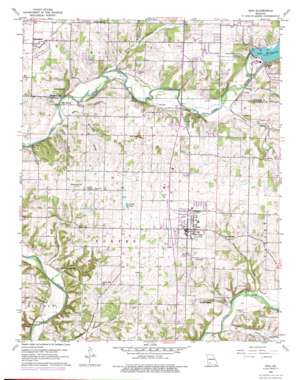
Nixa Topo Map Missouri
To zoom in, hover over the map of Nixa
USGS Topo Quad 37093a3 - 1:24,000 scale
| Topo Map Name: | Nixa |
| USGS Topo Quad ID: | 37093a3 |
| Print Size: | ca. 21 1/4" wide x 27" high |
| Southeast Coordinates: | 37° N latitude / 93.25° W longitude |
| Map Center Coordinates: | 37.0625° N latitude / 93.3125° W longitude |
| U.S. State: | MO |
| Filename: | o37093a3.jpg |
| Download Map JPG Image: | Nixa topo map 1:24,000 scale |
| Map Type: | Topographic |
| Topo Series: | 7.5´ |
| Map Scale: | 1:24,000 |
| Source of Map Images: | United States Geological Survey (USGS) |
| Alternate Map Versions: |
Nixa MO 1960, updated 1961 Download PDF Buy paper map Nixa MO 1960, updated 1969 Download PDF Buy paper map Nixa MO 1960, updated 1971 Download PDF Buy paper map Nixa MO 1960, updated 1974 Download PDF Buy paper map Nixa MO 1960, updated 1976 Download PDF Buy paper map Nixa MO 1979, updated 1981 Download PDF Buy paper map Nixa MO 2011 Download PDF Buy paper map Nixa MO 2015 Download PDF Buy paper map |
1:24,000 Topo Quads surrounding Nixa
> Back to 37093a1 at 1:100,000 scale
> Back to 37092a1 at 1:250,000 scale
> Back to U.S. Topo Maps home
Nixa topo map: Gazetteer
Nixa: Basins
Avin Sink elevation 366m 1200′Nixa: Bridges
Frazier Bridge elevation 317m 1040′Nelson Mill Bridge elevation 329m 1079′
Nixa: Dams
Lake Springfield Dam elevation 348m 1141′Nixa: Lakes
Willow Pond elevation 387m 1269′Nixa: Populated Places
Battlefield elevation 388m 1272′Guin elevation 348m 1141′
Kissick elevation 354m 1161′
Nixa elevation 395m 1295′
Riverpark elevation 380m 1246′
Nixa: Reservoirs
Lake Springfield elevation 348m 1141′Nixa: Springs
Blue Spring elevation 333m 1092′Indian Spring elevation 337m 1105′
Spout Spring elevation 363m 1190′
Wasson Spring elevation 356m 1167′
Young Spring elevation 331m 1085′
Nixa: Streams
Farmer Branch elevation 342m 1122′Needmore Branch elevation 340m 1115′
Ward Branch elevation 336m 1102′
Workman Branch elevation 350m 1148′
Nixa: Valleys
Elk Valley elevation 326m 1069′Saunders Valley elevation 335m 1099′
Spout Spring Hollow elevation 332m 1089′
Turkey Hollow elevation 317m 1040′
Nixa digital topo map on disk
Buy this Nixa topo map showing relief, roads, GPS coordinates and other geographical features, as a high-resolution digital map file on DVD:


