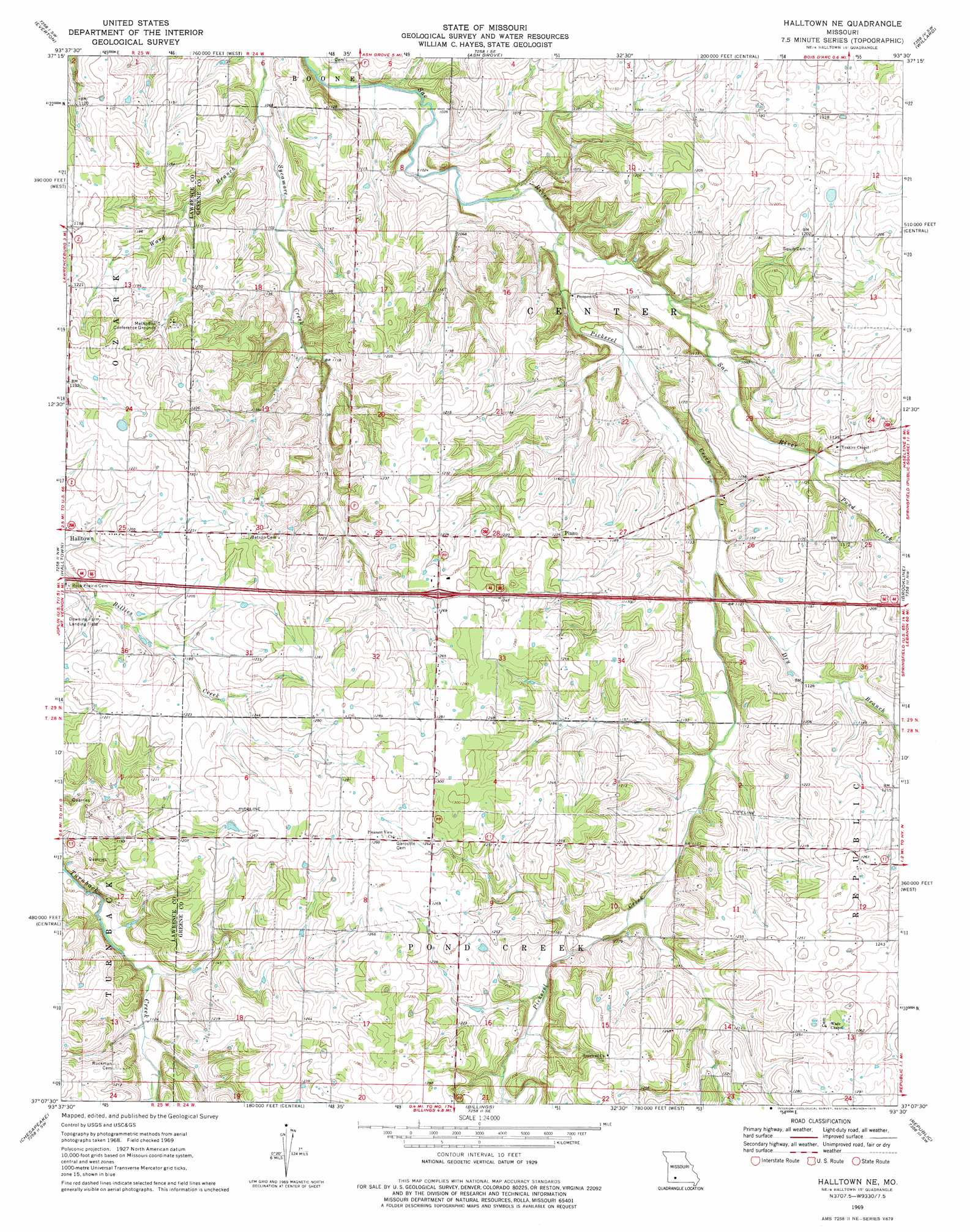
Halltown Ne Topo Map Missouri
To zoom in, hover over the map of Halltown Ne
USGS Topo Quad 37093b5 - 1:24,000 scale
| Topo Map Name: | Halltown Ne |
| USGS Topo Quad ID: | 37093b5 |
| Print Size: | ca. 21 1/4" wide x 27" high |
| Southeast Coordinates: | 37.125° N latitude / 93.5° W longitude |
| Map Center Coordinates: | 37.1875° N latitude / 93.5625° W longitude |
| U.S. State: | MO |
| Filename: | o37093b5.jpg |
| Download Map JPG Image: | Halltown Ne topo map 1:24,000 scale |
| Map Type: | Topographic |
| Topo Series: | 7.5´ |
| Map Scale: | 1:24,000 |
| Source of Map Images: | United States Geological Survey (USGS) |
| Alternate Map Versions: |
Halltown NE MO 1969, updated 1971 Download PDF Buy paper map Halltown NE MO 1969, updated 1975 Download PDF Buy paper map Halltown NE MO 2011 Download PDF Buy paper map Halltown NE MO 2015 Download PDF Buy paper map |
1:24,000 Topo Quads surrounding Halltown Ne
Greenfield |
Dadeville |
Walnut Grove |
Morrisville |
Pleasant Hope |
South Greenfield |
Everton |
Ash Grove |
Willard |
Ebenezer |
Miller |
Halltown |
Halltown Ne |
Brookline |
Springfield |
Mount Vernon |
Chesapeake |
Billings |
Republic |
Nixa |
Verona |
Aurora |
Crane |
Hurley |
Highlandville |
> Back to 37093a1 at 1:100,000 scale
> Back to 37092a1 at 1:250,000 scale
> Back to U.S. Topo Maps home
Halltown Ne topo map: Gazetteer
Halltown Ne: Airports
Kingsport Airport elevation 392m 1286′Halltown Ne: Populated Places
Plano elevation 373m 1223′Yeakley elevation 350m 1148′
Halltown Ne: Streams
Dry Branch elevation 329m 1079′Pickerel Creek elevation 317m 1040′
Pond Creek elevation 329m 1079′
Ward Branch elevation 317m 1040′
Halltown Ne digital topo map on disk
Buy this Halltown Ne topo map showing relief, roads, GPS coordinates and other geographical features, as a high-resolution digital map file on DVD: